Hawai'i Develops an Assessment and Implementation Plan to Strengthen the Climate Resilience of its Highway System

Hawai’i’s characteristics make it distinctively vulnerable to the effects of changing environmental conditions. As an archipelago in the tropics, Hawai’i contends with sea level rise, annual high wave flooding, tsunamis, coastal erosion, and storm surges. Increased extreme weather events and precipitation variability lead to more frequent rockfalls and landslides, while rising temperatures increase wildfire likelihood and severity. In an effort to understand and mitigate the effects of these diverse hazards on its highway infrastructure, the Hawaiian Department of Transportation (HDOT) developed a robust, preemptive Action Plan that can serve as a model for other transportation agencies throughout the country.
In response to these threats, HDOT is working to better understand how changing environmental conditions could impact Hawai’i’s portion of the National Highway System. HDOT originally developed its highway system based on the analysis of past conditions but determined the standards to be inadequate for the rise in unanticipated impacts from climate-amplified hazards. In 2021, HDOT conducted a comprehensive, data-driven Exposure Assessment report to understand the current and anticipated impacts of increasing hazards to the State’s highways. HDOT’s report informed the Action Plan’s strategies through historical and future environmental conditions research and data, including geographic, meteorological, and structural monitoring data. HDOT also developed an Asset and Hazard Map that details the locations and severity of affected assets for each identified hazard.
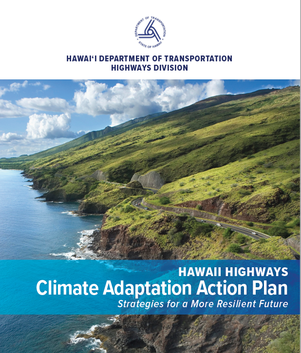
In May 2021, HDOT released The Hawai’i Highways Climate Adaptation Action Plan to help better define existing and potential future impacts on National Highway System (NHS) property and serve as a guide for making the Islands’ highways more resilient. The Action Plan uses forward-looking analysis that identifies hazards and impacts on transportation assets. The Action Plan sets forth recommendations in a multi-year implementation plan that involves all aspects of HDOT’s core functions and programs: funding, planning, designing, constructing, operating, maintaining, and protecting highway assets. HDOT will update the document regularly to reflect changes in conditions and implementation status.
The Action Plan discusses the urgent need for a resilient highway system, emphasizes the importance of institutional capacity building, and describes the next steps that HDOT will take to execute the Plan. HDOT will make future investments based on the understanding that the future conditions may be unlike those in the past. It will consider how future conditions may affect transportation assets and system users and utilize data-driven decision making when making resilient investments.
| How Did They Do It? | Applicable Tools |
|---|---|
|
Assessed climate risks.
|
Tools used: The following were used to collect data and determine current and anticipated threats to transportation assets: Federal Highway Administration – Highway Performance Monitoring System 2018 Public Release Federal Highway Administration – National Bridge Inventory Federal Highway Administration – National Tunnel Inventory National Oceanic and Atmospheric Administration – National Geodetic Survey |
|
Developed an implementation plan.
|
Tools used: Federal Highway Administration – Transportation Engineering Approaches to Climate Resiliency (TEACR) Study helped identify exposures and threats to the highway system. |
|
Identified data collection gaps for future assessments, design options, and investment support.
|
Tools used: The Federal Highway Administration - Adaptation Decision-Making Assessment Process (ADAP) was used to assess the future sensitivity of transportation to threats from changing environmental conditions. |
Similar Cases and More Information
For an example of how a municipality assessed and is planning to adapt to anticipated hazards, see the "City of Boston Plans for Adaptation" case study. Each city department used vulnerability assessments to integrate environmental vulnerabilities into future community plans.
For an example of how another state used a threat assessment to analyze potential and projected effects of sea level rise and coastal erosion, see the "Maryland Analyzes Coastal Wetlands Susceptibility to Climate Change" example. Maryland’s Departments of Natural Resources (MDNR) and Environment (MDE) used the Sea Level Affecting Marshes Model (SLAMM) to assess sea level rise projections and implement coastal wetlands restoration and conservation programs to protect the State’s remaining coastal wetlands.
- The City of Boston Plans for Adaptation
- Maryland Analyzes Coastal Wetlands Susceptibility to Climate Change
