Quinault Indian Nation Plans for Relocation
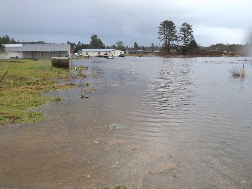
The Quinault Indian Nation village of Taholah is located within Washington State at the confluence of the Quinault River and the Pacific Ocean. Taholah is particularly vulnerable to sea-level rise, storm surge, and river flooding. These hazards and impacts are all expected to worsen with changing environmental conditions. The village is also concerned with the potential threat of tsunamis, a hazard unrelated to changing conditions.
The village’s vulnerability was highlighted in early 2014 and again in 2015 when storm surge and intense rains caused flooding, landslides, and culvert failures in the lower-lying areas of the village.
To better understand its risk into the future, the Nation conducted a vulnerability assessment with the assistance of a Social and Economic Development Strategies grant from the Administration for Native Americans. The resulting plan – which is incorporating numerous community discussions and forums - centers on relocating 650 residents and vulnerable community facilities a half-mile away from the existing village. The new village will be in a location well above the tsunami and flood zones.
The relocation plan, if implemented, prepares the village to be resilient to anticipated hazards and impacts such as storm surge and sea-level rise. Relocation would also protect the village from tsunamis. The expected inundation area from a 40-foot wave matches or exceeds the anticipated threat from storm surge and sea-level rise resulting from projected future changes.
Two additional points are worth noting. First, the Nation considered risks that have been associated with changing environmental conditions, as well as those that are not in determining its vulnerability and preparedness options. Second, the Nation used a tsunami threat standard and FEMA’s 1-in-100-year flood zone as the basis for selecting its tsunami risk and vulnerability preparedness strategy.
| How Did They Do It? | Applicable EPA Tools |
|---|---|
Identified potential hazards and impacts.
| The EPA Regional Climate Website can help you identify projected risks in your region. Climate Change: Resilience and Adaptation in New England (RAINE) |
Determined vulnerabilities (including the most vulnerable population) and preparedness options.
| EPA’s Coastal Storm Surge Mapper can help you determine whether your community may be vulnerable. |
Selected relocation as its adaptation action.
| EPA’s Tribal General Assistance Program Grants may be used to help tribal communities conduct an adaptation plan and inform actions. |
Engaged residents in the selected action.
| EPA’s Creating Resilient Water Utilities program can help communities host a disaster events workshop to identify community risk, engage residents and inform responses. |
Similar Cases and More Information
Determining risk and vulnerability and developing a preparedness plan are just two components of resilience. For an example of a community in the Northwest that used existing projections to promote preparedness planning, view the Anacortes Sea-Level Rise Example.
References