
Washington State DOT Develops a Vulnerability Assessment
Washington State’s transportation system faces several risks from increasing temperatures, wildfires, sea-level rise, and severe storms (such as ice storms and flooding) that are expected to affect the operation of transportation assets throughout the state.
In 2010, the Washington State Department of Transportation (WSDOT) used a grant from the Federal Highway Administration (FHWA) to assess future impacts of changing environmental conditions and develop its 2011 Climate Impacts Vulnerability Assessment (CIVA). WSDOT’s CIVA was a first step towards meeting the State’s 2011-2013 strategic goal to identify its assets that are at risk due to environmental hazards and impacts and determine potential solutions.
WSDOT took the following steps to create the CIVA:
- Drew on an existing FHWA model to develop its own tailored vulnerability assessment model (Figure 1) for planning, developing, and implementing a vulnerability assessment in Washington State.
- Drew on scientific analysis from the University of Washington Climate Impacts Group (CIG) to serve as a foundation of data for the CIVA.
- Utilized the data to conduct a GIS analysis to visualize the threats of sea-level rise, temperature changes, precipitation, wind, and fire facing WSDOT’s infrastructure.
- Convened 14 risk assessment workshops that engaged experts on state ferries, rail, and aviation across all regions in order to develop its risk assessment method for the vulnerability analysis.
- During the workshops, participants assessed the vulnerability of roadways and WSDOT-owned ferry, rail, and airport facilities, rating each one as high, medium, or low.
The value of the CIVA results to the State is evident in their widespread use by agencies and planners for decision-making and risk analysis. The CIVA results provide a strong basis for understanding potential vulnerabilities and strengths of WSDOT assets.
For all projects that are subject to the National Environmental Policy Act (NEPA) and the Washington State Environmental Policy Act (SEPA), State guidance notes that project planners should use the CIVA as a starting point for project-level NEPA/SEPA discussions. Planners should also consider the information in the vulnerability assessment as they examine risks.
Today, WSDOT incorporates the CIVA results in all program areas:
- Planning: Adaptation is a major emphasis area in the WSDOT strategic plan.
- Design & Environmental Review: Project teams evaluate potential risks using CIVA results during the environmental and design phase.
- Construction: WSDOT focuses on examining the potential for long-term impacts on materials to arise as a result of hazards and impacts, including saltwater corrosion, heat events, or precipitation changes.
- Operations & Maintenance: WSDOT engages in multi-hazard risk reduction incorporating awareness of maintenance activities that may be affected by heat or natural disaster events.
The review from the series of expert workshops provided WSDOT with additional insights on risks. The experts’ analysis revealed that many of WSDOT’s assets are already resistant to hazards and impacts. For example:
- Many of the improvements made for other reasons, such as seismic retrofits, fish passage improvements, culvert replacements, and drilled shaft bridges, resulted in WSDOT assets’ increased resistance to severe weather events. These existing strategies serve as examples of actions that could be taken in the future to increase the resiliency of WSDOT infrastructure.
- WSDOT has already worked on adaptation solutions for threats that will be exacerbated by changes in environmental conditions such as unstable slopes, flooding, and coastal erosion.
- Most of the newer bridges in the state are designed and built to be resistant to hazards and impacts.
- The State already monitors areas where some hazards and impacts are anticipated, such as critical bridges or Chronic Environmental Deficiencies (CEDs) sites. Examples of CEDs are designated highway locations that are vulnerable to flooding, sedimentation, and washouts.
Today, there is significant interest in WSDOT’s risk reduction and management efforts from outside parties. WSDOT has partnered with several state agencies to develop recommendations for local planners to conduct their own vulnerability assessments for roads and public works facilities.
| How Did They Do It? | Applicable Tools |
|---|---|
Developed a model for assessing the vulnerability of WSDOT assets. WSDOT drew on a 2009 version of FHWA’s Vulnerability Assessment Framework to develop a model for its state transportation vulnerability assessment. | Tools used: FHWA – Vulnerability Assessment and Adaptation Framework (2012 Edition) was used to analyze anticipated impacts of changing conditions on Washington State. |
Gathered hazard, impact and state transportation asset data.
| |
Conducted a vulnerability assessment.
| Tools used: WSDOT – Vulnerability Assessment assessed anticipated hazards and impacts on Washington State. Additional tools that may be useful: Climate Mapping for Resilience and Adaptation (CMRA) helps people assess their local exposure to hazards and impacts. CMRA provides current and future hazard and impact information to assist with prioritizing, identifying, and implementing informed infrastructure investments. |
Planned next steps:
|
Similar Cases and More Information
To learn about how a municipality assessed and is planning to adapt to anticipated hazards and impacts, see the City of Boston example. Each City department used vulnerability assessments to integrate vulnerabilities into future community plans.
To learn about how another state used a threat assessment to analyze potential and projected effects of sea-level rise and coastal erosion, see the Maryland example. Maryland’s Departments of Natural Resources (MDNR) and Environment (MDE) used the Sea Level Affecting Marshes Model (SLAMM) to assess sea-level rise projections and implement coastal wetlands restoration and conservation programs to protect the State’s remaining coastal wetlands from changing environmental conditions.
- The City of Boston Plans for Adaptation
- Maryland Analyzes Coastal Wetlands Susceptibility to Sea-Level Rise
References
- WSDOT - Vulnerability Assessment
- WSDOT Climate Resilience webpage
- WSDOT – Guidance for NEPA and SEPA Project-Level Climate Change Evaluations
- WSDOT – Guidance for Considering Impacts of Climate Change in WSDOT Plans
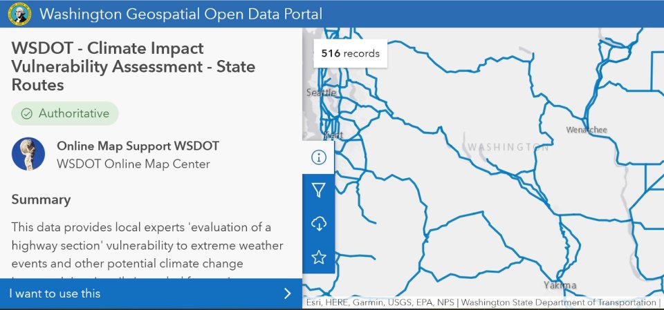
- Washington Geospatial Open Data Portal (roadway vulnerability ratings)
- Climate Impacts Group – Washington Climate Change Impacts Assessment