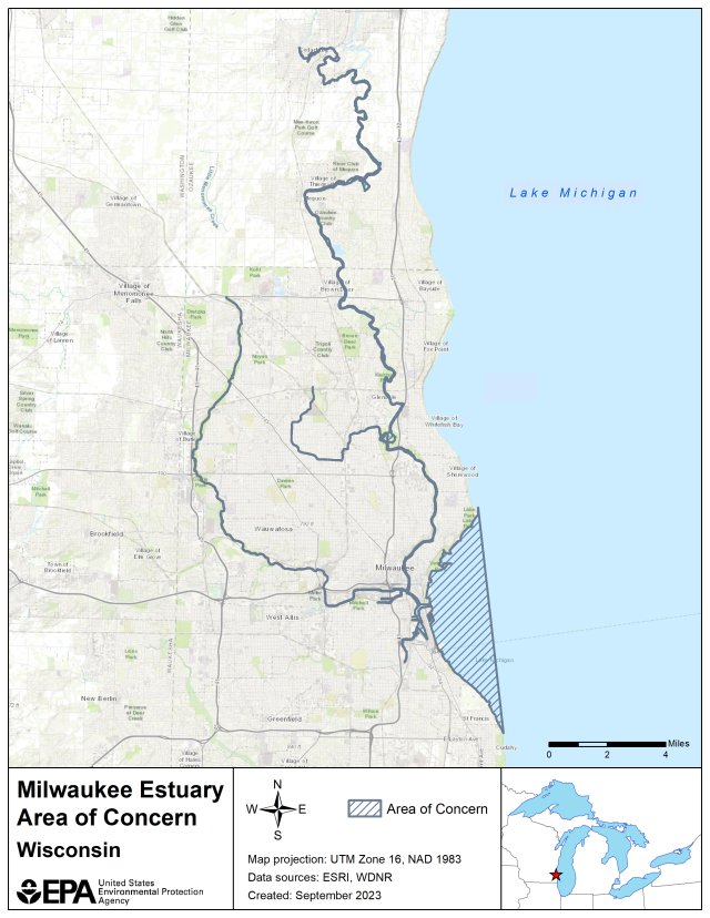
Milwaukee Estuary AOC Boundary Map

The original Milwaukee Estuary AOC included:
- the lower 3.1 miles of the Milwaukee River downstream of North Avenue Dam
- the lower 3 miles of the Menomonee River downstream of 35th Street
- the lower 2.5 miles of the Kinnickinnic River downstream of Chase Avenue
- the inner and outer Harbor and nearshore waters of Lake Michigan, bounded by a line extending north from Sheridan Park in the city of Cudahy to the city of Milwaukee's Linnwood water treatment plant
In 2008, the boundary was expanded to include the following:
- Cedar Creek downstream from Bridge Road to confluence with Milwaukee River
- Milwaukee River and Lincoln Creek from confluence with Cedar Creek to North Avenue Dam
- Little Menomonee River from Brown Deer Road to confluence with Menomonee River, and Menomonee River downstream from confluence with Little Menomonee River to 35th Street.
The following files are available for download for the Milwaukee Estuary AOC.
Milwaukee Estuary Area Shapefile (zip)
