
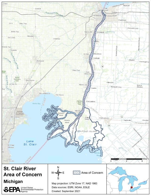
St. Clair River AOC Boundary Map
St. Clair River
The St. Clair River forms the upper most portion of the corridor between Lakes Huron and Erie serving as a connecting channel from Lake Huron to Lake St. Clair. The river flows approximately 64 km (40 mi) in a southerly direction from the outflow of Lake Huron to Lake St. Clair. Prior to entering Lake St. Clair, the river divides into several channels creating an extensive delta known as the St. Clair Delta/St. Clair Flats which are included in the AOC.
The following files are available for download for the St. Clair River AOC: