U.S. flag

An official website of the United States government

Here’s how you know

Dot gov

Official websites use .gov
A .gov website belongs to an official government organization in the United States.

HTTPS

Secure .gov websites use HTTPS
A lock (LockA locked padlock) or https:// means you’ve safely connected to the .gov website. Share sensitive information only on official, secure websites.

    • Environmental Topics
    • Air
    • Bed Bugs
    • Cancer
    • Chemicals, Toxics, and Pesticide
    • Emergency Response
    • Environmental Information by Location
    • Health
    • Land, Waste, and Cleanup
    • Lead
    • Mold
    • Radon
    • Research
    • Science Topics
    • Water Topics
    • A-Z Topic Index
    • Laws & Regulations
    • By Business Sector
    • By Topic
    • Compliance
    • Enforcement
    • Laws and Executive Orders
    • Regulations
    • Report a Violation
    • Environmental Violations
    • Fraud, Waste or Abuse
    • About EPA
    • Our Mission and What We Do
    • Headquarters Offices
    • Regional Offices
    • Labs and Research Centers
    • Planning, Budget, and Results
    • Organization Chart
    • EPA History

Breadcrumb

  1. Home
  2. EPA in Missouri

EPA Webinar: Using Fine-Scale Data for St. Louis Area via EnviroAtlas - April 8, 2020

– EPA Region 7 Feature –

  • Wednesday, April 8, 2020 - 2 to 3 p.m. Central
  • Webinar details and free registration

EnviroAtlas logo
EPA’s EnviroAtlas is a data-rich, web-based decision support tool that combines maps, analysis tools, downloadable data, and informational resources. It is used by states, tribes, communities and individuals to help inform policy and planning decisions that impact the places where we live, learn, work and play.

In December 2019, as part of its EnviroAtlas tool (www.epa.gov/enviroatlas), EPA released fine-scale mapping data for St. Louis and surrounding areas at a 1-meter resolution, adding it to a number of other communities for which this specialized ecological and built-environment information is available.
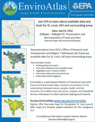
image of EnviroAtlas webinar flyer
Click to enlarge
This includes over 100 fine-scale datasets for the St. Louis area that may be of interest to those involved with urban planning, redevelopment, parks and recreation, geographic information systems (GIS), public health, education, and a range of other topics.

This webinar will provide a demonstration of available St. Louis area data and the EnviroAtlas online interactive mapping tool, including examples of how EnviroAtlas has been used by communities to advance local initiatives. (More information in flyer at right.)

For those who wish to stay for a longer question-and-answer session, there will be additional discussion time available from 3 to 3:30 p.m.

Speakers:
  • Jessica Daniel, EPA Office of Research and Development (daniel.jessica@epa.gov)
  • Andrew Wynne, EPA Region 7 (wynne.andrew@epa.gov)
Learn more:
  • EPA's EnviroAtlas website
  • EnviroAtlas Community Summary Fact Sheet
Contact Us to ask a question, provide feedback, or report a problem.
Last updated on February 18, 2025
  • Assistance
  • Spanish
  • Arabic
  • Chinese (simplified)
  • Chinese (traditional)
  • French
  • Haitian Creole
  • Korean
  • Portuguese
  • Russian
  • Tagalog
  • Vietnamese
United States Environmental Protection Agency

Discover.

  • Accessibility Statement
  • Budget & Performance
  • Contracting
  • EPA www Web Snapshot
  • Grants
  • No FEAR Act Data
  • Plain Writing
  • Privacy
  • Privacy and Security Notice

Connect.

  • Data
  • Inspector General
  • Jobs
  • Newsroom
  • Regulations.gov
  • Subscribe
  • USA.gov
  • White House

Ask.

  • Contact EPA
  • EPA Disclaimers
  • Hotlines
  • FOIA Requests
  • Frequent Questions
  • Site Feedback

Follow.