
Indicators: Lakeshore Habitat/Riparian Vegetative Cover
What is lakeshore habitat/riparian lakeshore vegetative cover?
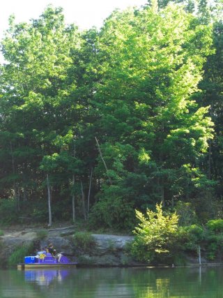
Riparian habitat refers to the physical features that make up the banks of rivers and shorelines of lakes. For example, areas of fast or slow water in streams, large boulders or bedrock outcrops, overhanging banks, and deep pools are all riparian habitats that serve the needs of aquatic species. Likewise, riparian vegetative cover consists of the vegetation corridor alongside streams, rivers and lakes. Vegetative cover refers to overhanging or submerged tree limbs, shrubs and other plants growing along the shore or banks of the waterbody.
Why is it important to evaluate lakeshore habitat/riparian vegetative cover?
Rivers, streams and lakes are home to many terrestrial and aquatic organisms, each of which have specific habitat needs. The presence of diverse, varied riparian habitat types can support a wide range of species. Likewise, rivers, streams and lakes can be buffered from the effects of human disturbance occurring in their watershed by varied, multi-layered vegetation in the land corridor that surrounds them. Healthy, intact vegetative cover in these riparian areas can help reduce nutrient and sediment runoff from the surrounding landscape, prevent bank erosion and provide shade to reduce water temperature. Vegetative cover can also provide leaf litter and large wood (such as branches and logs) that serve as food, shelter and habitat for aquatic organisms.
What can lakeshore habitat/riparian vegetative cover tell us about the condition of water?
The amount and variety of riparian habitat types provides information about the community of organisms that an aquatic system can support. Similarly, riparian vegetation lends insight into the health of rivers, streams, and lakes. The presence of large, mature canopy trees in the riparian corridor indicates riparian longevity. The presence of smaller, woody vegetation typically indicates that riparian vegetation is reproducing and suggests the potential for future sustainability of the riparian corridor. Riparian habitat and vegetative cover conditions vary naturally between the different ecological regions of the U.S. and also vary in response to human and natural disturbance, including development and flooding. With particular regard to lakes, drought and human activities that lower lake levels (termed “drawdown”) can result in bare ground being exposed along lakeshores, reducing the beneficial effects of healthy riparian ecosystems and altering the availability of habitat types along the lakeshore.
How is this indicator used in NARS?
Two surveys collect riparian habitat data which is available on the NARS data page. Below the table you access assessment information in current reports.
| NLA | NRSA | NCCA | NWCA | Indicator Type |
|---|---|---|---|---|
| X | X | Core Indicator | ||
| Research Indicator |
National Lakes Assessment Web Report – Lakeshore Habitat Results
National Rivers and Streams Assessment Web Report – Riparian Vegetation Cover Results