
The Future of Emissions Testing is Looking Up: How EPA is Using Drones to Test Air Quality
Published March 28, 2023
Toxic plumes created by large-scale burns, such as industrial catastrophes or wildland fires, can be devastating for communities and the environment. EPA is advancing air sensor technology and emission concentration testing practices to better understand downwind emission concentrations and discover new, more efficient ways to address toxic plumes.
Sampling Emissions From Above
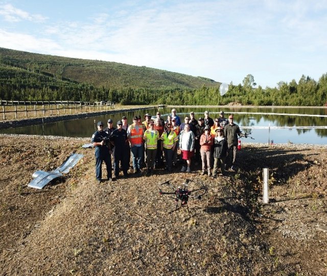
Over four days in August 2022, EPA researchers—in partnership with the Department of the Interior’s Bureau of Safety and Environmental Enforcement, NOAA, the U.S. Geological Survey, the U.S. Coast Guard, and the University of Alaska Fairbanks—flew a drone with a Kolibri sensor over a controlled oil fire to measure emission concentrations. EPA researchers have been developing and demonstrating the Kolibri, an air emission sensor/sampler instrument, for use on small unmanned aerial systems (sUAS) or drones and ground-mobile applications. The instrument can remotely and safely sample emissions from a variety of open area sources, such as wildland fires and industrial plumes.
The goal of the project was to collect emission concentration and geospatial data using the Kolibri drone. These data were released to NOAA and used by their modelers to calibrate dispersion models, which are models used to predict downwind emissions concentrations. Until now, dispersion models have only been calibrated using ground mobile sensors, which gather information at street level. Now, with the use of drones, researchers can use aerial emissions data to calibrate their models.
“The Alaska Kolibri experiment is a game-changer for atmospheric model evaluation and improvement. It provides unique, high-resolution information about the vertical and horizontal structure of the dispersing plume at different distances downwind. The experiment is unusually valuable in that downwind measurements of emitted pollutants along cross sections of the plume itself are made via a drone that is flying through the plume,” said NOAA partner, Mark Cohen.
Creating and Measuring a Controlled Burn
Researchers created a controlled small-scale oil burn event on a manmade pond owned by the University of Alaska Fairbanks. A pan of oil was placed in the center of the pond and surrounded by a circular boom—a floating structure that prevented oil from seeping out of the test area. The oil was then set on fire and a variety of drones were flown through the subsequent plume.
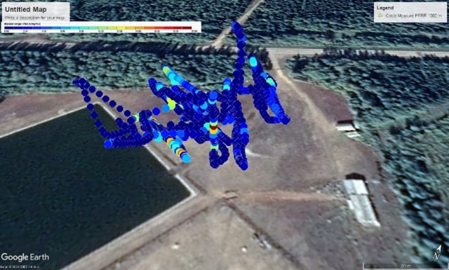
The U.S. Geological Survey flew their drone with an EPA Kolibri sensor attached back and forth through the plume to map emissions concentrations. The drone and Kolibri sensor recorded emission concentration versus time and GPS location to assess the concentration of downwind emissions and overall plume movement. The data collected were then plotted in a 3D map using Google Earth and Real Time Geospatial Data Viewer (RETIGO) to show how emission concentrations changed as altitude and meteorological conditions shifted. The emission concentration map is the first of its kind to use 3D technology.
Though the project’s main drone was the Kolibri sensor drone, the University of Alaska Fairbanks flew a second drone to capture video of the project, and the U.S. Coast Guard flew a third drone to collect real time data per their Special Monitoring of Applied Response Technologies (SMART) protocol. The SMART protocol is a cooperatively designed monitoring program for in situ burning and dispersants. Additionally, EPA collected data using a radiosonde—a balloon that recorded temperature versus altitude and location. With the help of these technologies, EPA and other project stakeholders collected a variety of useful meteorological, air quality, and emissions data that were then released to NOAA for further use and application.
What's Next for Aerial Emissions Testing
With the help of drones, EPA researchers can test emissions concentrations using aerial devices, increasing the accuracy of their models and the reach of their sensors. Understanding how emission concentrations change in burn scenarios helps EPA and others protect communities and the environment in emergency combustion situations. For example, with the help of well calibrated dispersion models, scientists can determine accurate evacuation radii for areas around toxic burns, which is integral for human health in burn situations
“Data from the Alaska project will be used to calibrate and improve upon dispersion models, help first responders predict the path and concentration hazard of plumes resulting from fires and industrial accidents, and allow on-scene coordinators to respond quickly and warn the downwind population of potential inhalation hazards,” said lead EPA scientist, Brian Gullett.
While the use of drones in air quality testing is relatively new, the data collected from the Alaska Kolibri has already proven valuable and EPA and partners look forward to further expanding the use of aerial air sensors in future research.
Learn More:
- EPA Unmanned Aircraft Systems (UAS) Program
- Kolibri System Enables Mobile Measurement of Air Emissions at the Source Fact Sheet
- Real Time Geospatial Data Viewer (RETIGO)
- Special Monitoring of Applied Response Technologies (SMART)
- Article: Tracking Wildfire Smoke: EPA Researchers Make Better Maps with Drones