
Aquifer Exemptions Map
On this page:
- Interactive aquifer exemptions map
- Facts on aquifer exemptions
- Aquifer exemption data initiative
- Downloadable data
Interactive aquifer exemptions map
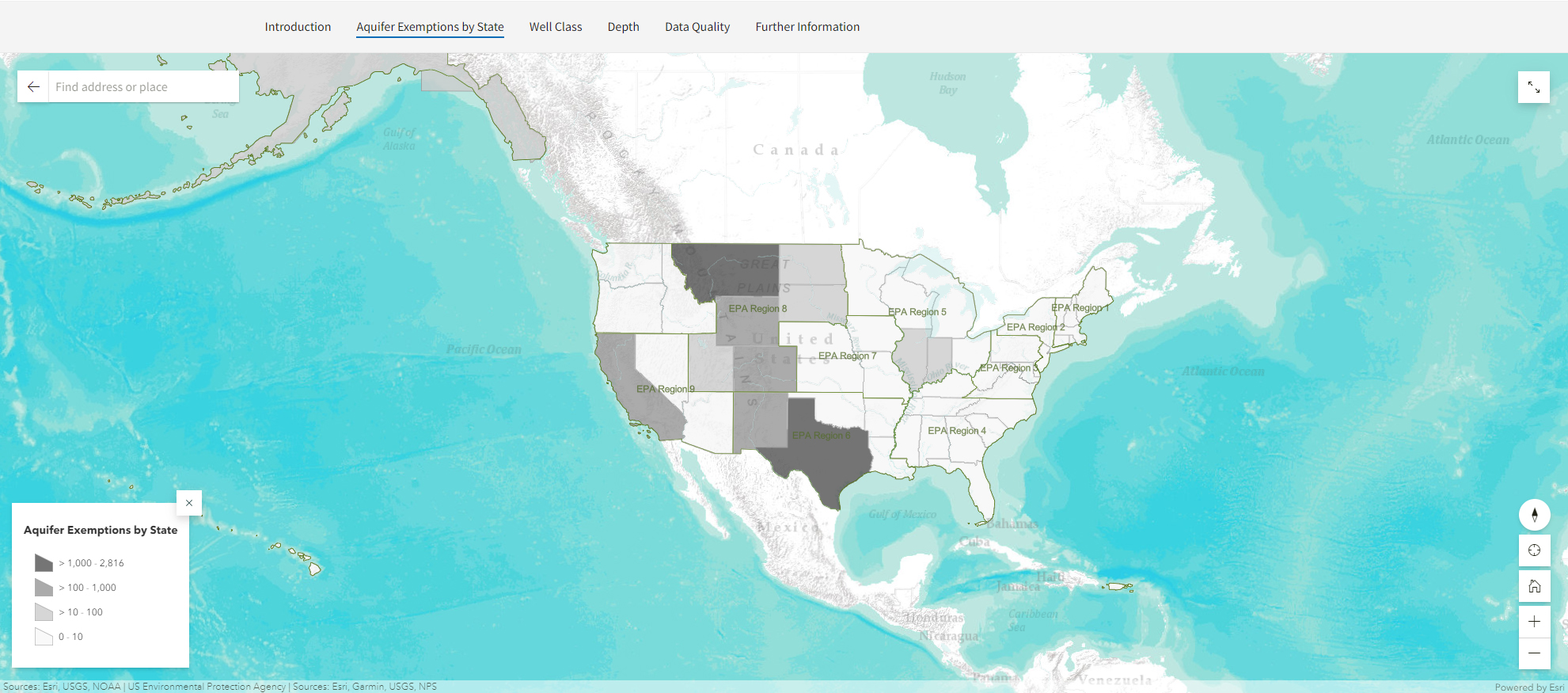
EPA’s interactive map allows users to find locations of aquifers approved for exemption under the Safe Drinking Water Act UIC regulations. The website also provides geospatial files and Excel data with an accompanying user guide. The map shows the approved aquifer exemption boundaries, when available, in two dimensions, and information such as the depth of injection, local geology, and injected fluid characteristics. The Excel spreadsheet provides descriptive information from the geospatial file without geospatial data. Users may download the datasets, a fact sheet, and a user guide from the Downloadable Data section on this page or the map’s "Further Information" tab.
The aquifer exemption data and map were prepared by EPA as an informational tool to assist users in understanding the number, locations, and the nature and quality of aquifer exemptions approved by EPA. Changes are periodically made to the data and map as information becomes available.
- Visit the Aquifer Exemptions Map on the EPA Geoplatform
- Review general information about aquifer exemptions and view frequently asked questions
Facts on aquifer exemptions
There are about 6,500 aquifer exemptions in the US. The majority of these are located in Montana, Wyoming, Colorado, California, Utah, Texas, and Indian country.
About 98 percent of aquifer exemptions are associated with Class II wells used for injection of fluids related to oil and gas production. Almost one-third of aquifer exemptions associated with Class II wells are for enhanced oil or gas recovery (Class IIR) and about one-fourth are for disposal of wastewater (Class IID). About one percent are associated with Class I industrial wastewater disposal wells, and another one percent of aquifer exemptions are associated with Class III wells, which assist in recovering minerals such as uranium and salts. The remainder are associated with Class V wells which are used to inject other non-hazardous fluids.
The depth of the exempted aquifers ranges from hundreds to thousands of feet below ground surface. About five percent of aquifer exemptions are 500 feet or less below the surface. Most depths are between 1,000 and 9,000 feet deep although some are over 10,000 feet deep. In some cases, there is more than one exempted aquifer at the same location, but at different depths and in different geologic formations.
Aquifer exemption boundaries are determined in a variety of ways. Some aquifer exemptions are defined as a radius (typically ¼ or ½ mile) around the well associated with the exemption and are circular. Others are defined by one or more grids in the Public Land Survey System and are squares or combinations of squares. Exemption boundaries can also be irregularly shaped and follow the dimensions of an aquifer, oil or gas field, or mining area. The exemption areas range in size from thousands of square feet to more than a thousand square miles (almost 36 percent are ¼ mile radius or smaller). Underground sources of drinking water in the surrounding area continue to be protected from endangerment under the Safe Drinking Water Act.
Aquifer exemption data initiative
EPA gathered available information about approved aquifer exemptions from the respective Regional offices, or state agencies to develop the dataset of aquifer exemption information. The Agency collected the aquifer exemptions information from paper files, spreadsheets, and databases generated over the past 35 years. EPA assessed the quality of the new dataset by comparing it to the original documents to confirm its accuracy. EPA continues to update this dataset annually as new data is collected and/or new aquifer exemptions are approved.
EPA developed a geospatial dataset that allows users to view or create a map of the aquifer exemption locations. The location of each exempted aquifer was converted from text descriptions to geospatial data. A table of attributes associated with each aquifer exemption polygon includes information on the state, county, depth, geologic formation, lithology, approval date, and regulatory criteria met. More information on each attribute can be found in the data dictionary in the user guide.
EPA developed an interactive Aquifer Exemption Map that allows users to find locations of aquifers approved for exemption under the Safe Drinking Water Act UIC regulations. Both the geospatial data and the attribute data are shown in the Aquifer Exemptions Map. Users can explore the data in the Aquifer Exemption Map or by downloading the files to create their own maps.
Downloadable data
Learn more about aquifer exemptions from downloadable files.
- A Fact Sheet on Aquifer Exemption Data that provides an overview of the aquifer exemptions and summarizes the number, depths, area and types of injection activities associated with aquifer exemptions.
- A user guide for aquifer exemptions data that describes how EPA developed the geospatial files shown in the Aquifer Exemptions Story Map and defines the data fields.
- A geospatial file with locations and information on each aquifer exemption (for use with geographic information system software).
- An Excel spreadsheet with information on each aquifer exemption.