
WATERS GeoViewer
Description
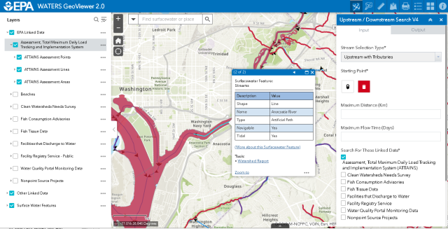
The WATERS GeoViewer tool is an EPA GeoPlatform based web mapping application that provides access to
- spatial data sets stored in WATERS, such as NHDPlus, EPA and Non-EPA Linked Data.
- Watershed level reports containing both NHDPlus and StreamCat information.
- Linked Data information, along with hyperlinks to web reports containing additional attribute information.
- interactive Upstream / Downstream Search capabilities supporting Linked Data discovery.
- interactive Watershed Delineation.
- underlying EPA GeoPlatform items that can be used to create other mapping applications.
Additional information about using the WATERS GeoViewer tool can be found in the WATERS GeoViewer tutorial.