Ecoregions of North America
Notice
If you are having issues downloading the files on EcoRegions website, we recommend you try opening the site in another web browser. Or copy the link address to another tab to open the attachment in a new window.
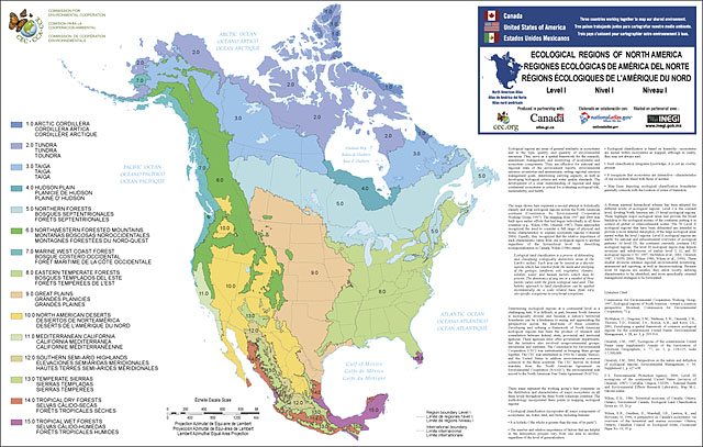
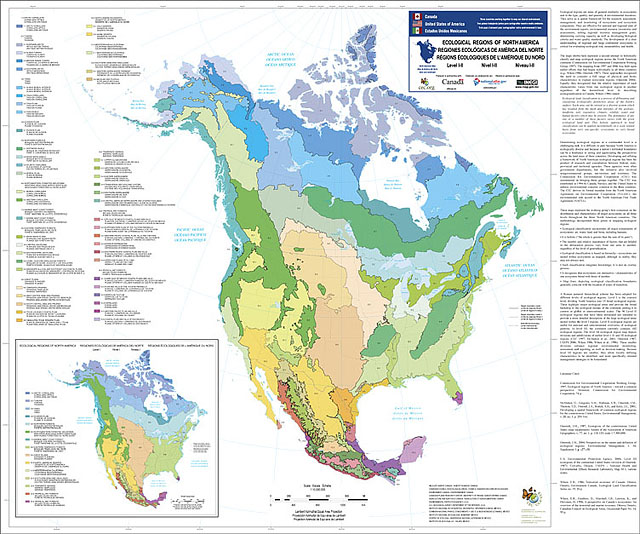
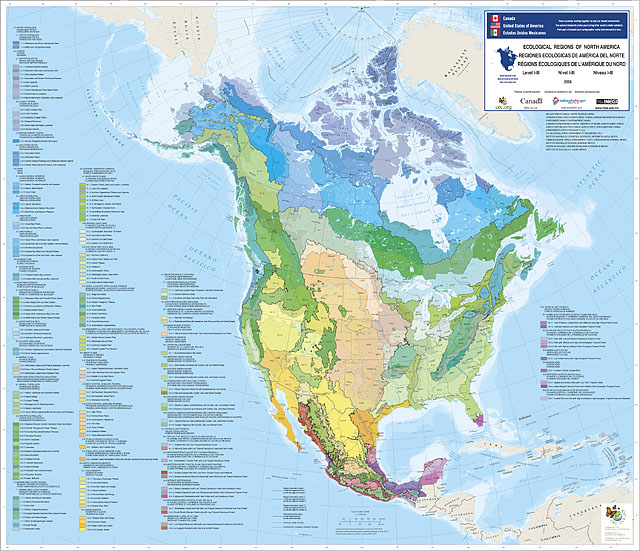
North America has been divided into:
- 15 broad, level I ecological regions;
- 50 level II ecological regions intended to provide a more detailed description of the large ecological areas nested within the level I regions; and
- 182 Level III ecoregions, which are smaller ecological areas nested within level II regions.
Select a link for additional details about each level, or a list of links to downloadable maps and GIS data files.
Level I Ecoregions
North America has been divided into 15 broad, level I ecological regions. These highlight major ecological areas and provide the broad backdrop to the ecological mosaic of the continent, putting it in context at global or intercontinental scales.
Viewing the ecological hierarchy at this scale provides a context for seeing global or intercontinental patterns. Level I ecological regions are: Arctic Cordillera, Tundra, Taiga, Hudson Plains, Northern Forests, Northwestern Forested Mountains, Marine West Coast Forests, Eastern Temperate Forests, Great Plains, North American Deserts, Mediterranean California, Southern Semi-Arid Highlands, Temperate Sierras, Tropical Dry Forests and Tropical Wet Forests.
Level II Ecoregions
The 50 level II ecological regions that have been delineated are intended to provide a more detailed description of the large ecological areas nested within the level I regions. Level II ecological regions are useful for national and subcontinental overviews of ecological patterns.
Level III Ecoregions
Level III mapping describes smaller ecological areas nested within level II regions. At level III, the continent currently contains 182 ecological regions. These smaller divisions enhance regional environmental monitoring, assessment and reporting, as well as decision-making. Because level III regions are smaller, they allow locally defining characteristics to be identified, and more specifically oriented management strategies to be formulated (CEC 1997).
Downloads
Maps (PDF format):
- Level I Ecoregions of North America: Full size map (PDF, 6 mb)
- Level II Ecoregions of North America: Full size map (PDF, 10 mb)
- Level III Ecoregions of North America: Full size map (PDF, 9 mb)
GIS data (shapefiles, metadata and symbology). Ecoregions of North America (contains level I, II, and III):
- Level I Ecoregions of North America Shapefile (28 mb)
- Level I Ecoregions of North America Metadata and Level I Ecoregions of North America Symbology
- Level II Ecoregions of North America Shapefile (30 mb)
- Level II Ecoregions of North America Metadata and Level II Ecoregions of North America Symbology
- Level III Ecoregions of North America Shapefile (34 mb)
- Level III Ecoregions of North America Metadata and Level III Ecoregions of North America Symbology
- Instructions for applying symbology to ecoregions
Ecoregion Descriptions:
- Ecological Regions of North America -Toward a Common Perspective (CEC 1997) (pdf = 6 mb)
- North American Level III CEC Descriptions (pdf = 2 mb)
- US Level III CEC Descriptions (Word doc)
CEC Website:


