Sanitary Surveys for Recreational Waters
A sanitary survey is a tool that allows users to investigate the sources of pollution and conditions in a recreational water body. Sanitary surveys help state and local waterbody managers identify sources of water pollution, assess the extent of the pollution, prioritize locations for water testing and develop models to predict recreational water quality. The data collected in sanitary surveys can include water quality data, weather conditions, waterbody conditions, recreational activities, wildlife observations, potential sources of pollution, harmful algal blooms and surrounding land use. State and local officials can then use the survey results to decide how to allocate resources to help improve water quality and protect recreators’ health.
The EPA developed a free application hosted on ArcGIS Survey123 to help waterbody managers conduct sanitary surveys and store their data.
EPA Sanitary Survey App for Marine and Fresh Waters
The EPA Sanitary Survey App for Marine and Fresh Waters is a free tool that waterbody managers can use to record waterbody data for evaluation. Users can record water quality data, weather conditions, waterbody conditions, recreational activities, wildlife observations, potential sources of pollution, harmful algal blooms, photos of the site and other related information. Users may also export the data they collected to analyze for use in predictive models and to inform management decisions. The data is geolocated and can be mapped and visualized. The app includes routine surveys that are useful for regular monitoring as well as comprehensive annual sanitary surveys. There are different surveys for marine waters and for freshwater lakes, rivers and streams.
Features
- Works on all mobile devices (smartphones, tablets, laptops)
- Free to use or store data, unlike similar apps
- Ability to share data with other users in your organization
- Accessible via ArcGIS Survey123 on Google Play or the App Store
- No WiFi or Internet needed for field use
- Can include photos
- Geolocates beach and waterbody locations
- Can download data in multiple formats (Shapefiles, CSV, Excel, GeoJSON)
Training Webinars
Access a recorded training on how to use the app and access saved data from the sanitary surveys.
Data Export Tool
Use the data export tool to quickly and easily download data, including photo attachments for one or more sanitary surveys in the app.
Model Quality Assurance Project Plan for Sanitary Survey App
A Quality Assurance Project Plan (QAPP) is required when the EPA Sanitary Survey App for Marine and Fresh Waters is used for any purpose. The Model Quality Assurance Project Plan was developed by the EPA for participatory science groups. This QAPP template can be tailored with project-specific information about the collection of environmental data when using the app and/or paper versions of the sanitary surveys.
Sanitary Surveys for Marine Waters

The EPA has developed routine and annual surveys that are specific to marine beaches. They are included in the EPA Sanitary Survey App for Marine and Fresh Waters and are also available in PDF versions. The survey forms include detailed questions on winds, tides, and other characteristics that affect marine waters and were not included on the survey forms for fresh waters.
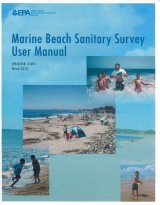
- Marine Sanitary Survey User Manual (pdf)
- Marine Routine Sanitary Survey for Recreational Waters (pdf)
- Marine Annual Sanitary Survey (pdf)
Sanitary Surveys for Fresh Waters

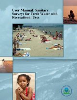
The EPA has developed routine and annual sanitary surveys that are specific to fresh (i.e., non-marine) recreational waters like lakes, rivers, and streams. They are included in the EPA Sanitary Survey App for Marine and Fresh Waters and are also available in PDF versions.

