
Superfund Sites in Reuse in Montana
If you are having trouble viewing the map in your browser, click the 'View larger map' link below
ACM SMELTER AND REFINERY
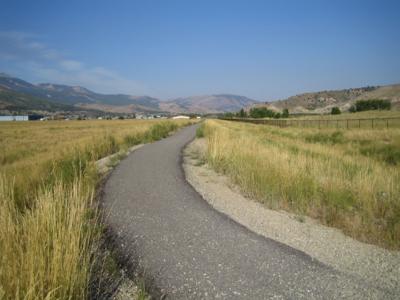
The ACM Smelter and Refinery Superfund site covers 2400-acres and a 40 mile stretch of the Missouri River in Cascade County, Montana, and includes a former facility area next to the unincorporated community of Black Eagle. In 1892, the Boston & Montana Consolidated Copper and Silver Mining Company built the first smelter on-site. Operations to concentrate, smelt and refine ore began in 1893. Electrolytic and furnace refineries were also on-site. In 1910, Anaconda Copper Mining Company acquired the property. Products included copper, zinc, arsenic and cadmium. Zinc smelting and refining activities continued until the early 1970s. In 1977, Atlantic Richfield Company bought the property. Copper refining continued until the plant closed in 1980. In 1981, a post-closure inventory was conducted for the plant; 27 areas of concern were identified. Eighty years of refinery operations contaminated soil, groundwater and surface water on and around the site with smelter waste, slag, tailings, arsenic, lead and other metals. EPA added the site to the National Priorities List in 2011. The Atlantic Richfield Company led a voluntary cleanup of the facility in the 1990s. The state of Montana requested that EPA lead a site investigation in 2002. A removal action in 2011 removed contaminated soil from the property and cleared the way for a new residential subdivision in Black Eagle. A removal action in 2020 removed contaminated soil on-site in an effort by the local water and sewer district to replace aging water and sewer lines. In 2024, yard cleanups began to address contaminated soil on residential properties. Investigation and cleanup activities are ongoing. Investigations have included sampling in residential yards, abandoned rail lines, a 3 mile stretch of the river, the former facilities area and adjacent areas. Current site uses include a recycling center, a golf course, a park with sports fields and picnic areas, a church, community center with bowling alley, and multiple restaurants. The site also provides wildlife habitat, hosts a protected natural area and supports residential housing. The stretch of the river of interest includes 5 hydroelectric dams, multiple boat launches, and is part of the Lewis and Clark National Historic Trail. The community of Black Eagle, located within the site is interested in locating a multi-use trail at the site along the rail lines, which is currently under design to be integrated with the remedy.
Last updated October 2025
As of December 2025, EPA had data on 3 on-site businesses. These businesses employed 48 people and generated an estimated $2,297,810 in annual sales revenue. For additional information click here.
For more information:
ANACONDA ALUMINUM CO COLUMBIA FALLS REDUCTION PLANT
The 1340-acre Anaconda Aluminum Co Columbia Falls Reduction Plant Superfund site is in Columbia Falls, Montana. Aluminum reduction took place on-site from 1955 to 2009. The plant stopped operating due to poor economic conditions for aluminum reduction. Disposal of spent potliner, and other wastes at the site, contaminated groundwater. EPA added the site to the National Priorities List in 2016. Partial demolition of the plant began in 2015 and finished in 2019. The remaining buildings and site areas are not in use, except for an industrial landfill. The site owner completed a time-critical removal action in fall 2020, removing contaminated sediments from the Flathead River floodplain. Long-term cleanup is scheduled to begin in 2026. Public services on-site include a Bonneville Power Administration rectifier yard and switchyard and a Burlington Northern rail line. The site owner is marketing the former plant area for commercial and industrial development. Anglers frequent the Flathead River, which received contaminated groundwater discharge from the site and has been evaluated as part of the baseline ecological risk assessment. The river is a fishery that is home to federally recognized endangered fish species such as bull trout and cutthroat trout.
Last updated October 2025
As of December 2025, EPA did not have economic data related to on-site businesses, or economic data were not applicable due to site use. For additional information click here.
For more information:
ANACONDA CO. SMELTER
The Anaconda Co. Smelter Superfund site is a former copper smelter in southwest Montana. It includes the towns of Anaconda and Opportunity. From 1884 to 1980, the smelter was the cornerstone of the local economy. It closed in 1980. It left behind more than 300 square miles of soil and water contaminated with heavy metals. EPA added the site to the National Priorities List in 1983. EPA worked with the community, Atlantic Richfield (the owners of the former smelting facility), the state of Montana and Anaconda-Deer Lodge County to clean up the site and support its redevelopment. In 1994, Atlantic Richfield began turning 250 acres of the site into an 18-hole golf course, a 3-hole short course called Little Bear, and a driving range. The courses and driving range combine the remedy with landscaping and preservation of historic mining artifacts. Cleanup also addressed homes and commercial properties in Anaconda, Opportunity and adjacent areas. Cleanup activities to address arsenic contamination at residential and commercial properties began in 2003. EPA’s Superfund Redevelopment Program supported a reuse assessment project at the site in 2005. Cleanup to address lead contamination began in 2015. To date, Atlantic Richfield has cleaned up more than 1,600 residential and commercial properties. More than 3,000 acres of agricultural land was restored to wetlands and comprise the largest wetland habitat in the Upper Clark Fork River Basin. There are also 550 acres of constructed wetlands in the opportunity ponds areas and thousands of acres of former waste disposal sites have been capped. These areas now provide wildlife habitat. The remedy has also made 30 million cubic yards of slag material available for reuse. Construction of the David Gates Power Generating Station at Mill Creek, a natural gas-fired electricity generation facility, finished in 2010. The original smelter stack is on the National Register of Historic Places and attracts visitors to Anaconda Smoke Stack State Park. A $10 million hotel and convention center, The Forge Hotel and Barclay II Supper Club, opened on-site in 2022. In 2023, a 45,000-square-foot retail facility for Murdoch’s Ranch and Home Supply Store opened on-site. Other redevelopments include a regional prison, an education center for the disabled, a search and rescue business and dozens of other commercial businesses.
Last updated October 2025
As of December 2025, EPA had data on 227 on-site businesses. These businesses employed 1,496 people and generated an estimated $237,221,661 in annual sales revenue. For additional information click here.
For more information:
BARKER HUGHESVILLE MINING DISTRICT
The 6,000-acre Barker Hughesville Mining District Superfund site is in Judith Basin County and Cascade County in west-central Montana. In 1879, miners found rich silver and lead ores in the area. Mining took place on-site through the 1940s. Mining activities and abandoned mines contaminated soil, sediment, groundwater and surface water at the site with arsenic, cadmium, iron, lead, zinc and several other hazardous substances. EPA added the site to the National Priorities List in 2001. To date, EPA and the mining company, Doe Run Resources, have completed several short-term cleanups. Cleanup activities have removed and disposed of contaminated wastes. EPA is developing a long-term cleanup plan. In 2015, the Montana Department of Fish, Wildlife & Parks and the U.S. Forest Service placed a fish barrier in Dry Fork Belt Creek to help restore native west slope cutthroat trout in the watershed. Doe Run Resources will continue to clean up groundwater and surface water. From 2016 to 2019, Doe Run Resources backfilled several underground mine areas and put in stormwater drainage systems. In 2017 and 2018, more waste and soil removal actions took place. Sampling and monitoring are ongoing. Continued site uses include residential, recreational, agricultural and commercial areas. Creeks, trails, a reservoir and a national forest are also on-site. The area is also used for recreational activities, including hiking and ATV riding. An active missile silo is also on-site. A buried optic-fiber cable crosses the site.
Last updated October 2025
As of December 2025, EPA had data on one on-site business. EPA did not have further economic details related to this business. For additional information click here.
For more information:
BASIN MINING AREA
The Basin Mining Area Superfund site covers about 77 square miles in Jefferson County, Montana. It includes the town of Basin and about 300 mine sites in the surrounding watersheds of Basin Creek, Cataract Creek and the Boulder River. From the 1870s to the late 1950s, hard-rock mining operations generated waste rock and tailings at the site. Heavy metals from the waste rock and tailings contaminated surface water, soil, sediment, groundwater, air and biota. EPA added the site to the National Priorities List in 1999. EPA dug up and disposed of contaminated residential soil and mine waste. EPA also backfilled and revegetated contaminated areas. Cleanup in the town of Basin finished in fall 2004. Land uses in Basin include neighborhoods, commercial areas, public services, and ecological and recreation areas. Cleanup of mine sites in surrounding watersheds is ongoing.
Last updated October 2025
As of December 2025, EPA had data on 8 on-site businesses. These businesses employed 29 people and generated an estimated $1,030,834 in annual sales revenue. For additional information click here.
For more information:
BILLINGS PCE
The Billings PCE Superfund site is northeast of downtown Billings, Montana. Several dry-cleaning operations in the area disposed of tetrachloroethylene improperly. This created a plume of contaminated groundwater that extends about 3 miles through neighborhoods and into downtown Billings. EPA has led short-term actions to remove contaminated soil, reduce and contain the groundwater contamination, and address indoor air contamination. EPA added the site to the National Priorities List in 2021 and has conducted groundwater, soil and indoor air sampling. The agency will expand investigations to identify homes that may need systems to reduce the threat of exposure to indoor air contamination. Cleanup planning to address potential indoor air contamination is ongoing. An interim Record of Decision is anticipated to be issued in 2026 followed by a source area ROD in 2027. EPA continues to work with the real estate community, the Billings Chamber of Commerce and the Downtown Billings Alliance to support the sale of residential and commercial properties in the site’s 1100-acre study area.
Last updated October 2025
As of December 2025, EPA had data on 5 on-site businesses. These businesses employed 22 people and generated an estimated $2,028,411 in annual sales revenue. For additional information click here.
For more information:
BURLINGTON NORTHERN (SOMERS PLANT)
The 80-acre Burlington Northern (Somers Plant) site is in Somers, Flathead County, Montana. From 1901 to 1986, industrial operations on-site included chemical treatment of railroad ties and other lumber products. These activities contaminated beach sediments about 150 feet into Flathead Lake as well as soil and groundwater on-site. EPA selected the site’s remedy in 1989. EPA proposed the site for listing on the National Priorities List in 1984 and removed it from NPL consideration in 1991, as the site is subject to the corrective action authorities of the Resource Conservation and Recovery Act Subtitle C. Cleanup activities included soil and groundwater treatment, removal of contaminated materials from the Swamp Pond, replacement of wetlands and a natural resource damages settlement. BNSF Railway Company completed wetland restoration at the Swamp Pond and acquired 7.5 acres of wetlands near the Waterfowl Production Area on Flathead Lake as part of the remedial action. BNSF also conveyed a perpetual wetland reserve easement to the U.S. Fish and Wildlife Service. BNSF bought residential properties at the site and demolished structures. Aside from structures related to cleanup, this area remains vacant. In 2022, the state put in an offshore gravel beach to prevent erosion along the north shore of Flathead Lake next to BNSF shoreline property. This beach and Flathead Lake are open for recreational use. The Great Northern Historical Trail, which runs across the site’s eastern boundary, is also in recreational use.
Last updated October 2025
As of December 2025, EPA did not have economic data related to on-site businesses, or economic data were not applicable due to site use. For additional information click here.
For more information:
BURLINGTON NORTHERN LIVINGSTON SHOP COMPLEX
The 90-acre Burlington Northern Livingston Shop Complex site is located mostly in Livingston, Montana. In 1883, the Northern Pacific Railroad built a rail yard at the site. By the early 1900s, the rail yard had expanded to include a passenger depot, machine shops, a turntable, a roundhouse and a powerhouse. Historical rail-yard operations, including waste treatment, storage and disposal practices, contaminated soil and groundwater. The site includes an area of groundwater contamination about 2 miles long and a half-mile wide. Facility operations ceased in 1986. Operations resumed a year later when Montana Rail Link bought part of the site. MRL runs a rail yard on-site. The facility includes locomotive and rail car repair and maintenance shops. Residential uses are located above the groundwater contaminant plume. Commercial businesses, including restaurants and a car dealership, are also on-site. Burlington Northern Railroad (now the BNSF Railway Company, or BNSF) began cleanup activities in 1988. After cleanup, operation and maintenance activities are ongoing. The Montana Department of Environmental Quality oversees cleanup and addresses the facility as a state Superfund site. BNSF uses green remediation practices as part of the cleanup. This effort includes using bacteria to help break down remaining shallow and deep groundwater contamination.
Last updated October 2025
As of December 2025, EPA had data on 22 on-site businesses. These businesses employed 133 people and generated an estimated $20,231,230 in annual sales revenue. For additional information click here.
For more information:
CARPENTER SNOW CREEK MINING DISTRICT
The 9,000-acre Carpenter Snow Creek Mining District Superfund site includes about 96 abandoned mines in the Little Belt Mountains of Cascade County, Montana. Most of the site is in Helena-Lewis and Clark National Forest. From 1882 to 1929, operators of the Neihart Mining District mined zinc and lead ore containing high amounts of silver. Mining activities ceased after World War II. Mineral extraction and processing left behind mine waste and mining-influenced water. In the early 1990s, the Montana Abandoned Mine Reclamation Bureau found metal concentrations at levels harmful for human health and the environment. EPA added the site to the National Priorities List in 2001. The agency then selected a cleanup plan for residential soils in the town of Neihart. Cleanup activities started in 2024. Monitoring and site characterization across the watershed are ongoing, with several removal actions completed to date. EPA is working on more cleanup plans for the site. Future cleanup efforts will address surface soils and mining-influenced waters. The Montana Department of Fish, Wildlife & Parks put in a fish barrier to protect cutthroat trout, a species of concern, in 2023. Road grading and culvert repair in fall 2024 prepared a haul route to the site’s designated repository at McKay Gulch. Yard cleanups will start in 2025. Continued uses at the site include ecological, residential, recreational, federal, public service and commercial areas.
Last updated October 2025
As of December 2025, EPA had data on 8 on-site businesses. These businesses employed 8 people and generated an estimated $766,433 in annual sales revenue. For additional information click here.
For more information:
EAST HELENA SITE
The East Helena site in East Helena, Montana, includes a former lead smelter, the city of East Helena, several residential subdivisions and surrounding agricultural lands. The former smelter, operated by ASARCO from 1888 to 2001, helped to define the community’s heritage. Its operations led to the contamination of large parts of the smelter facility, the city of East Helena and surrounding lands in Lewis and Clark County. EPA added the site to the National Priorities List in 1984. Cleanup efforts began in the early 1990s, when ASARCO removed contaminated soil from residential yards in East Helena. ASARCO continued these activities through the end of 2009, when EPA assumed responsibility for the residential-yard cleanup as part of the ASARCO bankruptcy settlement. EPA oversees the facility cleanup performed by the Montana Environmental Trust Group – the named trustee of the Montana Environmental Custodial Trust – as set forth in ASARCO bankruptcy settlement. To date, cleanup at the facility has included the demolition of structures, consolidation and covering of contaminated soil and sediment, replacement of manmade lakes with enhanced wetlands, land and groundwater use restrictions, and reconstruction of the Prickly Pear Creek channel and floodplain. These efforts have improved groundwater quality and prevented the exposure of people and migratory birds to contaminated soil. Cleanup of the former smelter facility is nearly complete. The last smelter-related cleanup measure, grading and capping a slag pile, will take place after the removal of the upper 2 million tons of slag for recycling. To support future development, the city of East Helena annexed former ASARCO-owned lands outside the city boundary in 2009. In 2010 and 2011, EPA’s Superfund Redevelopment Program funded a collaborative community-based reuse planning process. The project resulted in a development strategy for East Helena that focuses on opportunities for economic development and cultural heritage as well as habitat and recreation. A new elementary school and high school now stand on cleaned-up land. A new subdivision with about 300 homes is being developed on former ASARCO lands. In 2019, EPA’s Region 8 celebrated the METG East Helena Team with its Excellence in Site Reuse Award, recognizing their efforts in cleaning up and supporting the redevelopment of the site and lands formerly owned by ASARCO. In 2020, over 300 acres of former ASARCO property were transferred to Prickly Pear Land Trust (PPLT) for the construction and management of a greenway trail system that opened its first section in 2023. In 2025, PPLT opened Prickly Pear Park, which includes a gravel walking trail that follows the restored Prickly Pear Creek. The city’s long-term growth strategy centers on the redevelopment of former ASARCO lands. In 2022 and 2023, METG sold most of the remaining developable former ASARCO land in East Helena. These areas will host a planned community and affordable housing.
Last updated October 2025
As of December 2025, EPA had data on 76 on-site businesses. These businesses employed 572 people and generated an estimated $56,361,343 in annual sales revenue. For additional information click here.
For more information:
- Coming to the Table: Community Revitalization in Montana, The East Helena Superfund and RCRA Site in East Helena, Montana (PDF)
- East Helena, East Helena, MT - Reuse Plan (PDF)
- EPA Region 8 Excellence in Site Reuse Award
- Superfund Site Profile Page
FLAT CREEK IMM
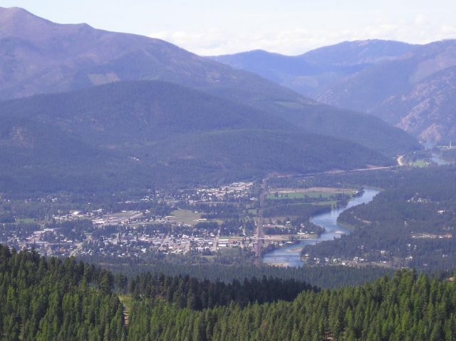
The Flat Creek IMM Superfund site is in Superior, Montana. From 1909 to 1930 and from 1947 to 1953, the Iron Mountain Mine was active on-site. It produced silver, gold, lead, copper and zinc ores. Mine operations produced tailings and soils contaminated with heavy metals. The local government and several community members brought tailings into Superior for use as fill material in yards, roadways and other locations, including a school track and fairgrounds. In 2000, a forest fire triggered a large runoff event that carried contaminated tailings into and around the Flat Creek watershed. These operations and events resulted in the contamination of residential areas and other properties as well as the Flat Creek watershed. The site includes the abandoned IMM mine, the Flat Creek watershed and the town of Superior. Parts of the site are in Lolo National Forest. EPA added the site to the National Priorities List in 2009. Cleanup consists of tailings removal. It is ongoing. Cleanup of residential yards finished in 2014. Today, the site remains in continued use. Commercial and residential areas, museums, county fairgrounds, schools and government offices are on-site.
Last updated October 2025
As of December 2025, EPA had data on 66 on-site businesses. These businesses employed 443 people and generated an estimated $27,813,589 in annual sales revenue. For additional information click here.
For more information:
- Reuse and the Benefit to Community: A Beneficial Effects Economic Case Study for the Flat Creek IMM Superfund Site (PDF)
- Superfund Site Profile Page
IDAHO POLE CO.
The 87-acre Idaho Pole Co. Superfund site is in Bozeman, Montana. From 1945 to 1997, the Idaho Pole Company ran a wood-treating facility on-site. Its operations contaminated soil and groundwater. EPA added the site to the National Priorities List in 1986. Cleanup included soil, sediment and groundwater treatment. Groundwater monitoring is ongoing. IPC owns about 65 acres of the site. Residential properties are on the northern part of the site. A small section of Interstate 90 crosses the property. About 41 acres of vacant property south of the interstate and some acreage north of the interstate are ready for commercial and industrial reuse. In 2019 and 2020, EPA’s Superfund Redevelopment Program provided support for reuse planning activities at the site, including discussions about future use with stakeholders, local governments and the public. In 2022, EPA negotiated a Prospective Purchaser Agreement with the buyer of the 41-acre parcel of vacant property located south of the interstate. Development is expected to start once infrastructure is in place.
Last updated October 2025
As of December 2025, EPA did not have economic data related to on-site businesses, or economic data were not applicable due to site use. For additional information click here.
For more information:
LIBBY ASBESTOS SITE
The Libby Asbestos Superfund site is in the northwest corner of Montana. It includes the cities of Libby and Troy, highways and railroads. Gold miners discovered vermiculite in Libby in 1881. Mining began in the 1920s and ended in 1990. The W.R. Grace Company owned and operated the mine operations most recently. Vermiculite uses ranged from construction materials, such as insulation and tiles, to soil amendments in gardens and fill for driveways in Lincoln County, Montana. By some estimates, while in operation, the Libby mine may have produced more than 80% of the world's supply of vermiculite. Asbestos co-mingled with vermiculite contaminated the Libby area with multiple pathways for exposure. EPA sent an Emergency Response Team to Libby in 1999 to investigate and begin removing asbestos in the community. Since 1999, EPA has worked with local, state and federal agencies to investigate over 7,600 residential and commercial properties and clean up more than 2,600 of these properties. In 2002, EPA added the site to the National Priorities List (NPL). EPA has completed cleanup at most properties in Libby and Troy; any access refusals have a notice in the property file. As of 2024, EPA in concurrence with the Montana Department of Environmental Quality has taken five of the site’s eight areas, or operable units, off the NPL. OU-1 (Former Export Plant, OU-2 (Former Screening Plant), OU-5 (Former Stimson Lumber Mill), OU-6 (BNSF Rail Corridor), and OU-8 (Highways/Roadways) are partially deleted. The Montana Department of Environmental Quality will continue to monitor these areas to ensure the protectiveness of the remedies and will utilize the Lincoln County Asbestos Resource Program as the Operation and Maintenance (O&M) Program for the site. EPA has actively supported economic development and reuse efforts in Libby and Troy. The agency worked with the Lincoln County Port Authority in 2004 and 2017 to support land use planning and reuse efforts for 400 acres of industrial and commercial properties, including the former Stimson Mill property. EPA sponsored meetings on economic revitalization in 2005 that targeted the real estate community and local contractors. EPA’s Superfund Redevelopment Program and EPA’s Region 8 hosted a visioning session in 2017 with property owners and other stakeholders to discuss a long-term vision for the redevelopment of the Kootenai Business Park. The session resulted in a redevelopment implementation framework to support more industrial and commercial businesses as well as more recreation opportunities. EPA collaborated with the city, county and community members on the redevelopment of Riverfront Park. This multi-use facility includes river access, pavilions, a memorial, parking, picnic tables and fishing areas. The park also hosts Libby’s annual Riverfront Blues Festival. After cleanup and restoration activities, the city officially dedicated Riverfront Park in August 2013. In November 2018, EPA presented its Excellence in Site Reuse award to the city of Libby and other stakeholders for the cleanup and redevelopment of the areas that are now Riverfront Park. EPA also worked with the community to clean up a golf course in OU-4 and support the development of a trail and fishing pond in OU-5. In 2025, EPA is conducting its third Five-Year Review and seven out of the eight operable units are in the State-led O&M phase or the last stage of the Superfund process. EPA anticipates partial deletion of the residential/commercial properties in Libby and Troy (OU-4 and OU-7, respectively) soon and continues work on OU-3 (Former Vermiculite Mine) which is in the Feasibility Study stage of the Superfund process.
Last updated October 2025
As of December 2025, EPA had data on 357 on-site businesses. These businesses employed 2,270 people and generated an estimated $265,328,487 in annual sales revenue. For additional information click here.
For more information:
- Recreational and Ecological Use at Superfund Sites Story Map
- Libby Reuse Planning Summary (PDF)
- Out of the Dust: Recreational Reuse After Vermiculite Mining at the Libby Asbestos Superfund Site in Libby, Montana (PDF)
- Ready for Reuse: Lincoln County Industrial Property (PDF)
- EPA Region 8 Excellence in Site Reuse Award
- Superfund Site Profile Page
Pride and Perseverance: Community Engagement and EPA Cleanup of the Libby Asbestos Superfund Site
LIBBY GROUND WATER CONTAMINATION
The Libby Ground Water Contamination Superfund site is on the eastern edge of Libby, Montana. The site’s groundwater contamination plume is under parts of the city of Libby and county land, including land owned by the Lincoln County Port Authority – Kootenai Business Park, and is part of the larger Libby Asbestos Superfund site. The site was part of a lumber and plywood mill that treated wood from 1946 to 1969. Past operating practices and the release of wood-treating fluids resulted in contamination of soil and groundwater. In 1979, EPA’s investigations found well water contamination at a nearby home. EPA added the site to the National Priorities List in 1983. Cleanup began in 1986. It is ongoing. Cleanup activities include connecting homes to the public water supply, well closures and payments to owners, institutional controls, and soil and groundwater treatment. Site uses include recreational, commercial and light industrial areas. Residential areas are also part of the site. In 2020, EPA updated the remedy to expedite soil and groundwater cleanup. Remedial action for the cleanup of the upper aquifer is ongoing. Portions of the former mill property, previously owned by the Lincoln County Port Authority, are being developed for commercial and light industrial use and are supported by new utility lines and road access to the property.
Last updated October 2025
As of December 2025, EPA did not have economic data related to on-site businesses, or economic data were not applicable due to site use. For additional information click here.
For more information:
LOCKWOOD SOLVENT GROUND WATER PLUME
The 580-acre Lockwood Solvent Ground Water Plume Superfund site is in Billings, Montana. In 1986, sampling found benzene and chlorinated solvents in water supply wells. Investigations identified an area of groundwater contamination originating from Beall Trailers of Montana and Soco West (formerly Brenntag West). The Beall Trailers facility made and repaired tanker truck trailers used to transport asphalt. From 1978 to 1990, operators cleaned trailers with industrial solvents and steam prior to maintenance and repair. Wastewater went into a septic system drain field on-site. The primary sump in the former Steam Bay was cracked due to freeze-thaw events, resulting in the release of contaminants below the structure. Soco West ran a chemical repackaging and distribution company on-site. Operations at both facilities resulted in the contamination of soil and groundwater. EPA added the site to the National Priorities List in 2000. Cleanup includes groundwater monitoring, soil and groundwater treatment, and the establishment of a permanent controlled groundwater area and a community education program. In November 2023, EPA led an emergency removal action at the Soco West Property. This effort involved capping and stabilizing contaminated soils, winterizing the property, and fencing the site’s western perimeter and an open excavation area. Groundwater sampling will resume in 2025. The site remains in continued use. Residential, commercial and industrial areas are on-site. A small part of Interstate 90 also crosses the site.
Last updated October 2025
As of December 2025, EPA had data on one on-site business. This business employed 5 people and generated an estimated $4,770,000 in annual sales revenue. For additional information click here.
For more information:
MILLTOWN RESERVOIR SEDIMENTS
The Milltown Reservoir Sediments Superfund site extends from the headwaters of the Clark Fork River at Warm Springs Ponds in Deer Lodge County, Montana, to the former dam location in Milltown, Montana. From the 1860s until the late 20th century, the Clark Fork and Blackfoot Rivers region in western Montana was one of the richest mining areas in the world. A flood in 1908 sent large quantities of mining waste from the Butte and Anaconda mining districts into the Milltown Reservoir. The Milltown Reservoir Sediments Operable Unit includes about 540 acres in the Clark Fork River and Blackfoot River floodplain and consists of the area encompassed by the former Milltown dam and reservoir. Elevated levels of arsenic were found in local drinking water in 1981. EPA added the site to the National Priorities List in 1983. Cleanup of the Milltown Reservoir Sediments Operable Unit included removal of contaminated sediments and restoration of the floodplain. Remedy construction was completed in 2012. In 2005, assisted by an EPA Superfund Redevelopment Program pilot grant, area communities developed a reuse plan for the site. Milltown State Park opened to the public in 2018 with trails, river access, wildlife habitat and interpretive areas celebrating the region’s history and heritage. The Clark Fork River Operable Unit, which begins at the most-downgradient point of the Butte Silver Bow Superfund Complex and continues for about 120 river miles to Milltown, Montana, is in various stages of remedial design and remedial action. Part of the Clark Fork River Operable Unit is in Deer Lodge in Powell County, Montana, and the river flows through Arrowstone Park. Arrowstone Park is used for recreation and includes an asphalt trail network and river access for fishing and floating. In response to Powell County requests for assistance, the Superfund Redevelopment Program provided reuse planning assistance to in support of Powell County’s master plan for Arrowstone Park.
Last updated October 2025
As of December 2025, EPA had data on one on-site business. EPA did not have further economic details related to this business. For additional information click here.
For more information:
- Redevelopment of the Milltown Reservoir/Clark Fork River Superfund Site (PDF)
- Integrating the "3 Rs": Remediation, Restoration and Redevelopment- The Milltown Reservoir Sediments Site and Missoula County, Montana (PDF)
- Superfund Site Profile Page
In-the-Moment Video: Community Meeting for Reuse Visioning in Deer Lodge, Montana
Video: Sustainability in Region 8: Milltown River Restoration
MONTANA POLE AND TREATING
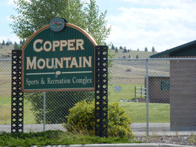
The 40-acre Montana Pole and Treating Superfund site is located in Butte, Montana. From 1946 to 1983, a wood-treating facility on-site preserved utility poles, posts and bridge timbers. Its operations and waste disposal practices contaminated groundwater, surface water, sediment and soil. EPA added the site to the National Priorities List in 1987. Cleanup included treatment of contaminated soil and sediment, water treatment, and relocation of sewer and drinking water pipes. Institutional controls at the site restrict groundwater use and residential uses. An interstate highway that crosses the site divides it into two work areas. The water treatment plant remains active on the northern part of the site. Groundwater and surface water monitoring are ongoing. In 2021, the Montana Department of Environmental Quality (MDEQ), in coordination with EPA, updated the remedy, setting more stringent cleanup standards. EPA recently awarded a redevelopment seed to the Montana Pole Site to support reuse efforts. The site has potential to be used for recreation, including the extension of a trail connection between Copper Mountain and Silver Bow.
Last updated October 2025
As of December 2025, EPA did not have economic data related to on-site businesses, or economic data were not applicable due to site use. For additional information click here.
For more information:
MOUAT INDUSTRIES
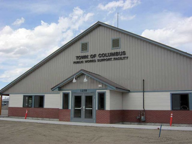
The 4.5-acre Mouat Industries Superfund site is in Columbus, Montana. It lies in the historic floodplain of the Yellowstone River. From 1957 to 1962, Mouat Industries’ chromite ore operation was active on-site. It generated wastes that contaminated soil and groundwater. EPA added the site to the National Priorities List in 1986. Working with EPA, several potentially responsible parties demolished the former processing facility, containerized or relocated wastes, treated contaminated soil and groundwater, and put groundwater and land use controls in place. Cleanup construction finished in 1996. In 2009, EPA took the surface and subsurface soil areas of the site off the NPL. In 2011, the town of Columbus built a new public works building on part of the site. The remainder of the site has a vegetated cap and a gravel cover or is the former location of Timberweld, a wood manufacturing company that shut down in 2015. Maintenance of the soil covers and groundwater monitoring are ongoing. Timberweld assets, including the property, went to auction in March 2017. A fencing company purchased one parcel for the storage of supplies and materials. A steelworkers union purchased another parcel. EPA is working with the new property owners to support redevelopment opportunities that are compatible with the site’s remedy.
Last updated October 2025
As of December 2025, EPA had data on 3 on-site businesses. EPA did not have further economic details related to these businesses. For additional information click here.
For more information:
SILVER BOW CREEK/BUTTE AREA
The Silver Bow Creek/Butte Area Superfund site is in Butte, Montana, and the surrounding area. It consists of the Berkeley Pit and the underground mine workings of the historic Butte Mining District (Butte Hill), the urban centers of Butte and Walkerville, rural areas outside of Butte where mining took place, and treatment/settling ponds at the Warm Springs Ponds. It also includes 26 miles of stream and streamside habitat downstream from Butte. Starting in the late 1800s, mining operators dumped mining wastes into areas in and around Butte, including streams and wetlands near mining operations. Emissions from mining operations and improper waste disposal activities contaminated soil, groundwater and surface water with heavy metals. EPA added the site to the National Priorities List in 1983. The Butte Area was added to the site in 1987. Since 1988, EPA has completed cleanup actions to address immediate and long-term threats to human health and the environment. Cleanup actions include addressing areas around former smelter sites, mine waste dumps, railroad beds, stream banks/channels and residential yards in Butte and Walkerville. Cleanup of the Silver Bow Creek area included off-site disposal of contaminated sediment and restoration of stream banks and flood plains. It is ongoing. The 26-mile stream habitat is home to native fish, insects, hundreds of bird species and wetlands. The Warm Spring Ponds area is a designated wildlife management area administered by the Montana Department of Fish, Wildlife and Parks. It offers habitat for migrating waterfowl and breeding areas for dozens of songbird species and osprey. It also offers recreation trails for biking and hiking. The Rocker Timber area, located west of Butte, includes industrial and railroad uses as well as part of the Greenway Trail. The Berkeley Pit area includes the waters in the 475-acre Berkeley Pit, underground mine workings and associated aquifers. Cleanup of the Berkeley Pit area includes diverting runoff to the pit, hazing efforts to keep migratory birds away from the pit and a community education campaign. Mining continues in the nearby Continental Pit. The Butte Priority Soils and Westside Soils area include commercial, residential and recreational areas west of Butte and Walkersville. Since the mid-1990s, the Residential Metals Abatement Program has cleaned up residential yards and interior dust across the area. In 2020, a Consent Decree was approved for final cleanup actions, including treating stormwater and groundwater, capping mine waste areas, and removing more mine waste along Silver Bow and Blacktail Creek. The Consent Decree also sets aside 120 acres for connected greenways in Butte. These greenways will include natural park spaces with reconstructed wetlands, native plants, wildlife habitat, interpretative signage, playground features, trails and boardwalks for all-season access. Construction in the Silver Bow Creek Corridor began in 2024. Across the site’s seven active operable units, regular inspection, monitoring and investigation efforts are ongoing. Remedial action activities are ongoing for some operable units at the site.
Last updated October 2025
As of December 2025, EPA had data on 373 on-site businesses. These businesses employed 4,345 people and generated an estimated $495,957,927 in annual sales revenue. For additional information click here.
For more information:
- Silver Bow Superfund Site - Before and After Swiper Map
- Building on Mining History: Cleanup, Reuse and Community Resilience at the Silver Bow Creek/Butte Area Superfund Site in Butte, Montana (PDF)
- Superfund Site Profile Page
SMURFIT-STONE MILL FRENCHTOWN
The 3,200-acre Smurfit-Stone Mill Frenchtown site is 11 miles northwest of Missoula, Montana. A pulp and paper mill operated on-site from 1957 to 2010. EPA proposed adding the site to the National Priorities List in 2013. EPA is investigating the presence of mill-related chemicals and wastes in groundwater, surface water, soils and sediments. Sampling and monitoring of groundwater and soil are ongoing. O’Keefe Creek, La Valle Creek and Clark Fork River are next to the site; they include wetland areas. The Clark Fork River supports a variety of fish, including the federally designated threatened bull trout. The site investigation includes the Clark Fork River – Grass Valley Important Bird Area, named due to its significance to bird species of conservation concern. Local residents and nearby Missoula-valley residents, along with a steady supply of tourists during the summer months, use the Clark Fork River for recreation, including for camping, hiking and fishing. The State of Montana has issued a fish consumption advisory for the Clark Fork River, specifically from its confluence with the Bitterroot River to the confluence with the Flathead River near Paradise. This advisory has been in place since 2020 and is based on findings of significant chemical contaminants in fish tissue, particularly in species such as rainbow trout and northern pike. About 1,200 acres at the site remain in agricultural use for cattle grazing and growing alfalfa and grain crops. The part of the Clark Fork River next to the site is a Wildlife Protected Area for bald eagle nesting, a high-density bald eagle winter concentration area, a big-game critical wintering/spring area and a peregrine falcon nesting area.
Last updated October 2025
As of December 2025, EPA did not have economic data related to on-site businesses, or economic data were not applicable due to site use. For additional information click here.
For more information:
UPPER TENMILE CREEK MINING AREA
The Upper Tenmile Creek Mining Area Superfund site covers about 53 square miles in Lewis and Clark County, Montana. It consists of about 150 hard rock mines in the historic Rimini Mining District located within 20 miles of Helena, Montana. Metals mining began in the 1870s and continued through the 1930s. The byproduct of these activities was mine waste rock containing heavy metals that contaminated soil, groundwater and surface water. From 1987 to 1990, The Montana Department of State Lands (now the Montana Department of Environmental Quality) removed waste rock and tailings material from 11 abandoned mine sites and disposed of the materials at an active mine in Jefferson County. At each of the mine sites, the land was recontoured, stabilized in place, covered and revegetated. From 1996 to 2001, EPA assisted state agencies in relocating mine waste from several abandoned mines to a secure storage area. EPA added the site to the National Priorities List in 1999. In 2002, EPA finalized a long-term cleanup plan for the site. It included the treatment of soil in residential and historic mining areas and the treatment and testing of surface water and groundwater. EPA revised the cleanup plan in 2008 to indicate that surface water would be the source water for the Rimini public water system and residential properties would require individual septic systems. As of 2024, most homes in Rimini and several in the Landmark subdivision receive drinking water from EPA’s bottled water program. EPA completed the cleanup at the Rimini Road (Basin Creek Mine Road) area of the site in 2010. Cleanup of unpaved roads in residential areas finished in 2011. EPA’s cleanup of contaminated mine waste from the Lee Mountain – Little Lily Mine Complex in Rimini finished in 2013. In 2017, the cleanup of mine waste from the National Extension and Bunker Hill Priority Mine Group finished. In 2016, EPA completed the cleanup of residential soils to which EPA had access. There are still residential properties identified for remediation. EPA is working with Lewis & Clark County and the state to establish rules for groundwater use and to put institutional controls in place. Cleanup and monitoring are ongoing. In 2002, EPA’s Superfund Redevelopment Program supported the City and Lewis & Clark County’s community-based planning process to develop future land use recommendations for the site. Cleanup construction in 2023 and 2024 took place under a Cooperative Agreement with the state and included solid media removal, installation of irrigation ditches, placement of clean soil and revegetation. The U.S. Forest Service-administrated lands make up the majority of the site. Most of the land is undeveloped and used for recreation. Other uses include recreational hunting and fishing on undeveloped parts of the site. Surface water from Tenmile Creek is used for flood irrigation of hay and other crops.
Last updated October 2025
As of December 2025, EPA did not have economic data related to on-site businesses, or economic data were not applicable due to site use. For additional information click here.
For more information: