
Superfund Sites in Reuse in Washington
If you are having trouble viewing the map in your browser, click the 'View larger map' link below
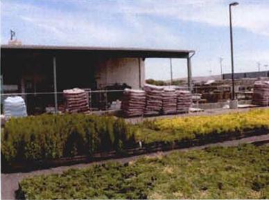
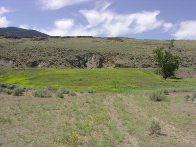
AMERICAN CROSSARM & CONDUIT CO.
The 16-acre American Crossarm & Conduit Co. Superfund site is in Chehalis, Washington. The facility dumped wastewater contaminated with wood-treating chemicals, fuels and solvents into an unlined pit. This activity, combined with periodic flooding from nearby rivers, spread hazardous wastes onto nearby properties and contaminated groundwater. In 1989, EPA added the site to the National Priorities List. Cleanup actions included removing contaminated soil, demolishing contaminated structures, removing oil from groundwater and covering excavated areas with clean soil. An EPA cleanup lien on the site presented a reuse barrier to developers. In the late 1990s, EPA agreed to remove the lien on the condition that any new owners add fill so the property is out of the floodplain. Owners must also not dig into the site’s cap, use the groundwater or sell the property without transferring the land use restrictions. This agreement made redevelopment possible. A new structure was built on-site in 1998. In 2020, EPA determined that no further cleanup actions were necessary and took the site off the NPL. Commercial businesses are now on-site. They include a children’s education facility, a fitness center and a repair shop. An industrial facility, homes and wetlands are also on-site.
Last updated October 2025
As of December 2025, EPA had data on 8 on-site businesses. These businesses employed 81 people and generated an estimated $6,184,820 in annual sales revenue. For additional information click here.
For more information:
BOEING COMPANY TULALIP TEST SITE
The 525-acre Boeing Company Tulalip Test site lies within the Tulalip Tribes Indian Reservation in Marysville, Washington. The U.S. Department of Defense condemned and purchased the property for U.S. Army Ammunition Storage and training purposes during World War II. In 1949, the U.S. Government sold the land back to the Tulalip Tribes, which then leased the depot site to the U.S. Army and later to the Boeing Company. Boeing used the area from 1954 to 1999 as a test location for aviation and rocket components for military and commercial applications. Activities during that time contaminated groundwater and soil with hazardous chemicals. The site is not on the National Priorities List but is an NPL-caliber site and is being addressed through the Superfund Alternative Approach. Investigations and cleanup activities are ongoing. Due to the large size of the site and multiple different locations of contamination, there is not a one-size-fits-all reuse plan. Some locations are likely to be restored as a wetland conservation area, while others are being considered for development. No official development plans have been announced by the Tribes to date. EPA is working with the Tulalip Tribes and Boeing to support the site’s return to use.
Last updated October 2025
As of December 2025, EPA did not have economic data related to on-site businesses, or economic data were not applicable due to site use. For additional information click here.
For more information:
BREMERTON GASWORKS
The 2.8-acre Bremerton Gas Works Superfund site is in Bremerton, Washington, along the Port Washington Narrows in Puget Sound. From 1930 to 1963, a manufactured gas plant made gas for lighting and heating. After it closed, other industrial operations took place on-site, including metal fabrication, concrete forming and boat repair. Industrial activity on-site contaminated soil, sediments and groundwater. In August 2010, community members reported surface water sheen on the Port Washington Narrows near the former MGP. Kitsap Public Health District investigations identified a concrete pipe as the source of the sheen. In October 2010, Cascade Natural Gas identified itself as a potentially responsible party and signed an Administrative Order for response actions at the site. By November 2010, CNG had plugged the pipe and placed a cover over affected sediment. EPA added the site to the National Priorities List in 2012. EPA oversees CNG’s ongoing long-term cleanup of the site. Federally protected steelhead trout and chinook salmon are nearby. The area is used as a sport and commercial fishery as well as for subsistence fishing by the Suquamish Tribe. A marina with 80 boat slips is also on-site.
Last updated October 2025
As of December 2025, EPA had data on 2 on-site businesses. These businesses employed 4 people and generated an estimated $535,750 in annual sales revenue. For additional information click here.
For more information:
COMMENCEMENT BAY, NEAR SHORE/TIDE FLATS
The Commencement Bay, Near Shore/Tide Flats Superfund site is in the cities of Tacoma and Ruston, Washington. It includes a commercial seaport at the southern end of Puget Sound, with 10 to 12 square miles of shallow water, shoreline and adjoining land. There is a U.S. Army reserve center located between the Hylebos and Blair waterways. The site also includes the former Asarco Tacoma Smelter Facility and Breakwater Peninsula, the Tacoma Tar Pits, offshore contaminated sediments, and residential yards of Tacoma and Ruston contaminated by smelter emissions. The site’s tidal areas support recreational and tribal fisheries. Beginning in the late 1800s, shipbuilding, oil refining, chemical manufacturing and storage, lead and copper smelting and other industrial activities took place at the site. These activities resulted in the contamination of soil, groundwater, surface water and sediment. In 1983, EPA added the site to the National Priorities List. EPA began working with the state of Washington’s Department of Ecology and the Puyallup Tribe of Indians on the investigation and cleanup plan in the 1980s. The Washington Department of Ecology (Ecology) oversaw the cleanup of the St. Paul Waterway prior to the site’s listing on the NPL. Ecology facilitated the restoration of 11 acres of shallow marine habitat for ecological reuse. The Port of Tacoma performed the first cleanup action at the Sitcum Waterway part of the bay. These activities resulted in newly available land on the Milwaukee Waterway. The additional space allowed for the expansion of a land-sea marine terminal facility. The expansion helped make the Port of Tacoma the seventh-largest container port in the nation. Cleanup activities in the Hylebos and Thea Foss Waterways took place in the early 2000s. Cleanup activities also allowed for redevelopment, including the construction of the Museum of Glass and the Chihuly Bridge of Glass public art project, residential units, restaurants and park space, as well as restoration of 70 acres of coastal habitat. EPA continues to work with landowners and local governments to coordinate cleanup plans with the community’s future land use goals. In 2006, Point Ruston, LLC purchased the Asarco Tacoma Smelter Facility property and agreed to take over its cleanup and redevelopment. The developer coordinated with EPA on site development and remedial capping efforts. Buildings and hard surfaces serve as part of the site’s capped area and connect to the surrounding multi-layer cap. The Point Ruston development includes commercial, public, residential and recreation areas. Condominiums, restaurants and stores as well as parks and waterfront walkways are now open on-site. EPA also partnered with Parks Tacoma to clean up and support the redevelopment of the 23-acre Breakwater Peninsula. Metro Parks Tacoma built a public park over the capped area in July 2019. Cleanup efforts are complete across the former Asarco Tacoma Smelter Facility; development of some areas is ongoing. The Washington Department of Ecology and Tacoma-Pierce County Health Department partnered with EPA to clean up contaminated soils in private yards and public areas, including schools, playgrounds and parks, near the former smelter. To date, the cleanup has addressed more than 3,000 properties.
Last updated October 2025
As of December 2025, EPA had data on 782 on-site businesses. These businesses employed 15,836 people and generated an estimated $4,125,196,430 in annual sales revenue. For additional information click here.
For more information:
- Superfund Site Profile Page
- Restoring and Revitalizing Waterfront Resources: Tacoma’s Thea Foss Waterway: The Commencement Bay Near Shore/Tide Flats Superfund Site in Tacoma, Washington (PDF)
COMMENCEMENT BAY, SOUTH TACOMA CHANNEL
The Commencement Bay, South Tacoma Channel Superfund site is in Tacoma, Washington. It spans 2.5 square miles and consists of three separate project areas – the South Tacoma Field, the Tacoma Landfill and Well 12A. Since 1982, site activities across these three areas have included the operation of a landfill, rail car manufacturing, repair and maintenance, waste oil reprocessing, and operation of two foundries in support of the local railroad. Site activities and improper waste disposal contaminated soil and groundwater with hazardous chemicals. Tacoma City Light has been active on the north end of South Tacoma Field since 1953. EPA added the site to the National Priorities List in 1983. Cleanup included soil removal and capping, development restrictions and monitoring of natural processes to clean up groundwater. Several commercial and industrial businesses are active on the southern half of the South Tacoma Field area. In 2021, 150 acres of the South Tacoma Field area were conveyed to Bridge Point Tacoma, LLC. Uses at the former landfill include a refuse compaction/transfer center, a household hazardous waste facility, a recycling center, an environmental education facility and solid waste management offices. In 2019, the Well 12A cleanup project received an Honor Award for Environmental Sustainability from the American Academy of Environmental Engineers & Scientists. The Academy recognized the project for its coordination among several agencies as well as design innovations and efficiencies. Well 12A continues to provide drinking water for the city and multiple commercial and retail businesses continue to operate within the Well 12A cleanup area.
Last updated October 2025
As of December 2025, EPA had data on 20 on-site businesses. These businesses employed 604 people and generated an estimated $84,210,778 in annual sales revenue. For additional information click here.
For more information:
FMC CORP. (YAKIMA)
The 4-acre FMC Corp. (Yakima) Superfund site is in Yakima, Washington. A pesticide formulation facility was on-site from 1951 to 1986. From 1952 to 1969, FMC disposed of agricultural pesticides in a pit. Its activities contaminated groundwater and soil with pesticides. EPA added the site to the National Priorities List in 1983. Under an EPA order, FMC disposed of about 850 tons of contaminated soil off-site in 1988 and 1989. In 1990, EPA required that FMC remove and incinerate contaminated soils on-site. FMC completed the cleanup in 1993. Land use controls prevent exposure to remaining soil and groundwater contamination. A building materials supply store and a hardware and garden store are now on-site.
Last updated October 2025
As of December 2025, EPA had data on 2 on-site businesses. These businesses employed 16 people and generated an estimated $2,539,000 in annual sales revenue. For additional information click here.
For more information:
- Reuse and the Benefit to Community: FMC Corp. (Yakima Pit) Superfund Site (PDF)
- Superfund Site Profile Page
FRONTIER HARD CHROME, INC.
The half-acre Frontier Hard Chrome, Inc. Superfund site is in Vancouver, Washington. From 1958 to 1970, Pioneer Plating ran a chrome plating business on-site. Frontier Hard Chrome also ran a chrome plating business on-site from 1970 to 1983. Disposal practices resulted in the chromium contamination of soil and groundwater. In 1982, officials found contamination in an industrial supply well about a quarter mile from the site. EPA added the site to the National Priorities List in 1983. Cleanup included soil treatment, natural attenuation of groundwater, institutional controls and groundwater monitoring. After cleanup, EPA took the site off the NPL in 2018. In spring 2018, an industrial contractor opened a 65,000-square-foot pipe fabrication facility and company offices at the site.
Last updated October 2025
As of December 2025, EPA had data on one on-site business. This business employed 30 people and generated an estimated $3,791,000 in annual sales revenue. For additional information click here.
For more information:
GENERAL ELECTRIC CO. (SPOKANE APPARATUS SERVICE SHOP)
The General Electric Co. (Spokane Apparatus Service Shop) Superfund site is in Spokane, Washington. It covers less than 2 acres. It includes the General Electric property as well as several industrial properties to the north and west. From 1961 to 1980, General Electric cleaned and repaired electrical transformers on-site. It stored polychlorinated biphenyl-contaminated waste oils at the site and disposed of them in on-site dry wells connected to the sewer. These activities contaminated surface soils and groundwater with PCBs. Northwesterly groundwater flow transported PCB contamination to other properties. EPA added the site to the National Priorities List in 1989. Cleanup activities, managed by the Washington Department of Ecology, included the removal of more than 27,000 tons of soil. Long-term groundwater monitoring began in 1994. It is ongoing. The former General Electric property is now vacant. Two auto-repair shops are active on-site.
Last updated October 2025
As of December 2025, EPA had data on 2 on-site businesses. These businesses employed 3 people and generated an estimated $283,180 in annual sales revenue. For additional information click here.
For more information:
GRAIN HANDLING FACILITY AT FREEMAN
The 1-acre Grain Handling Facility at Freeman Superfund site is in Freeman, Washington. Rockford Grain Growers built a grain handling facility on-site in 1955. The facility used carbon tetrachloride to deter rodents. Chloroform is a byproduct of the breakdown of carbon tetrachloride. Both chemicals contaminated soil and groundwater in the area. Sampling first detected groundwater contamination in a primary water supply well for the Freeman School District in 2001. Continued monitoring found contamination levels repeatedly exceeded safe drinking water standards. EPA added the site to the National Priorities List in 2015. EPA has not selected a remedy yet. As an interim action, point-of-entry water treatment systems were installed in school buildings and affected homes in 2016. The Washington State Department of Ecology manages the site. In 2021, Ecology released its responsiveness summary, addressing public comments about the state’s Remedial Investigation and Feasibility Study. Ecology is working on a Cleanup Action Plan based on guidelines in the Model Toxics Control Act. The grain-handling facility remains active on-site. Other site uses include the Freeman School District and several homes.
Last updated October 2025
As of December 2025, EPA had data on one on-site business. EPA did not have further economic details related to this business. For additional information click here.
For more information:
HAMILTON/LABREE ROADS GW CONTAMINATION
The Hamilton/Labree Roads GW Contamination Superfund site is 2 miles southwest of Chehalis, Washington. To manage investigations and cleanup, EPA divided it into two operable units. OU-1 is known as the Hamilton Road Impacted Area. OU-2 includes the S.C. Breen Construction Company Property, the Thurman Berwick Creek Area and all other affected areas outside of the HRIA. In total, the site includes about 21 acres of land southwest of U.S. Interstate 5 and along North Hamilton Road to its intersection with Labree Road. Spills and dumping in Berwick Creek, as well as burying drums and other containers containing solvents contaminated soil, sediment, surface water and groundwater. In 1993, the Washington State Department of Health testing found contamination in six wells in the area. A removal action in 1999 removed drums and associated contaminated soil, supplied bottled water to affected well owners, and connected affected homes to the municipal water supply. EPA added the site to the National Priorities List in 2000. EPA published the site’s Interim Record of Decision in 2013. The site’s interim cleanup began in 2020 and was completed in 2024. EPA is the lead agency, and the Washington State Department of Ecology is the support agency. The interim cleanup included temporarily re-routing the creek around the contamination and treating contaminated sediment, soil and groundwater. Institutional controls are required to limit future land use. Today, monitoring, investigations, and cleanup planning are ongoing. Sediment and soil excavations have finished. Thermal treatment of contaminated soil and groundwater has also been completed. Berwick Creek has been restored to its pre-project, free-flowing condition. Native riparian vegetation was planted for bank stability. Performance monitoring is ongoing. In conjunction with the cleanup underway at OU-1, EPA is leading the remedial investigation and feasibility study for OU-2 to collect information on downgradient sources and to identify sitewide remedial action alternatives that will achieve the long-term protection of human health and the environment. In 2021, the site was among those selected by EPA to receive additional funding. With this funding, EPA is working on backlogged remedial construction projects and accelerating cleanups at NPL sites. East of Labree Road and west of Interstate 5, site areas are primarily commercial. All other areas of the site west and northwest of Labree Road are zoned for rural residential and agricultural uses. These land uses include a livestock market auction house with a cafe, for sale commercial/industrial properties (formerly a logging business and a trucking company) as well as homes and farms.
Last updated October 2025
As of December 2025, EPA had data on 2 on-site businesses. These businesses employed 3 people and generated an estimated $782,480 in annual sales revenue. For additional information click here.
For more information:
LOCKHEED WEST SEATTLE
The Lockheed West Seattle Superfund site is on the southwestern shoreline of Elliott Bay in Seattle, Washington. It is next to the Port of Seattle’s Terminal 5 and the West Waterway. It includes the former shipyard support operations area. The 40-acre site also includes about 7 acres of aquatic tidelands owned by the Port of Seattle and 33 acres of state-owned aquatic lands. Past shipbuilding practices at the former shipyard released contaminants into the bay. Before its transfer to the Superfund program, the state of Washington listed the site as a “sediment cleanup priority project” under state cleanup authority. EPA added the site to the National Priorities List in 2007. EPA selected the site’s remedy in a 2013 Record of Decision. Lockheed Martin Corporation began the cleanup in 2018. It included dredging and disposal of contaminated sediments, institutional controls and long-term monitoring. Lockheed Martin completed the cleanup in 2020. Tribal members from the Muckleshoot and Suquamish Tribes continue to harvest seafood from around Harbor Island. EPA and Lockheed Martin coordinated with Tribal members throughout the cleanup process. The West Waterway part of the site includes a federal navigation channel that remains in use. The Port of Seattle expanded Terminal 5, including pier structures, as a container terminal along the West Waterway. The Port of Seattle began the $500 million expansion project in 2019 and completed it in 2022. The Port of Seattle completed phase two of the expansion project in 2024. The terminal now has 185 acres of cargo capacity. The U.S. Army Corps of Engineers received congressional approval through the Water Resources Development Act of 2018 to proceed with deepening the navigation channel in both the East Waterway and the West Waterway. Deepening is authorized to 57 feet and the U.S. Army Corps of Engineers is proceeding with the design of the West Waterway. Natural areas at the site support birds, crabs and fish, including salmon, as well as recreational uses, including net fishing, beach play and clamming.
Last updated October 2025
As of December 2025, EPA did not have economic data related to on-site businesses, or economic data were not applicable due to site use. For additional information click here.
For more information:
LOWER DUWAMISH WATERWAY
The Lower Duwamish Waterway Superfund site is a 5-mile stretch of the Duwamish River that flows into the East Waterway and West Waterway (part of the Harbor Island Superfund site) then into Elliott Bay in Seattle, Washington. The South Park and Georgetown neighborhoods and industrial corridors flank the waterway. A century of heavy industrial use left the waterway contaminated with toxic chemicals from many sources. In response to contamination in sediments, fish and shellfish, EPA added the site to the National Priorities List (NPL) in 2001. Local governments, the Port of Seattle and Boeing, collectively known as the Lower Duwamish Waterway Group, led investigations and early cleanup activities with oversight from EPA and the state. In 2014, EPA selected a cleanup plan that includes active sediment cleanup through dredging, capping and enhanced natural recovery over an estimated 177 acres. EPA continues to work with the liable parties on next steps implementing the cleanup plan. Part of the remedy includes institutional controls, such as covenants to protect sediment caps and provide information on safer seafood consumption choices. The Washington State Department of Health issued a seafood consumption advisory, focused on resident fish and shellfish, with fewer restrictions on salmon. The Lower Duwamish Waterway supports many uses. The U.S. Army Corps of Engineers maintains the central part of the waterway as a federal navigation channel, enabling its use for bulk and container shipping, water-dependent businesses and moorage. Recreation enthusiasts use the waterway for boating, kayaking, fishing and beach play. It also provides habitat for fish, shellfish and wildlife. Native American tribes have treaty-protected rights to cultural uses and seafood harvest in the Lower Duwamish Waterway, including a tribally managed commercial salmon fishery. Many people from communities in the area also fish in the waterway. In 2020, the Port of Seattle broke ground on Duwamish River People’s Park. The park opened to the public in summer 2022. The park restores habitat and increases public access to the river. In addition to the park and the Boeing Plant 2 habitat restoration area across the waterway, other restoration sites are likely to be completed following completion of the ongoing Natural Resource injury assessment.
Last updated October 2025
As of December 2025, EPA did not have economic data related to on-site businesses, or economic data were not applicable due to site use. For additional information click here.
For more information:
MAKAH RESERVATION WARMHOUSE BEACH DUMP
The 8-acre Warmhouse Beach Dump Superfund site is located in the Makah Indian Reservation at the northwest tip of the Olympic Peninsula in Clallam County, Washington. The Warmhouse Beach Dump was used in the late 1960s to 2012, when a solid waste transfer station run by the Makah Tribe opened near Neah Bay. The dump received mostly municipal and some hazardous wastes prior to closure. The Warmhouse Beach Dump Site was added to the Superfund National Priorities List (NPL) in December 2013. The Makah Tribe is the support agency and therefore plays a role in the review and concurrence of the remedial process. The RI was conducted between 2013 and 2023, and included sampling soil, sediment, and surface water at the dump, as well as assessing the waste material itself. In 2025, EPA developed the feasibility study which identified, developed, screened, and evaluated remedial alternatives to address risks to human health and the environment from waste at the dump. EPA issued a Proposed Plan in April 2025 announcing the preferred alternative for site cleanup. The preferred alternative includes the excavation of shallow contaminated media in the dump and disposal at an off-site facility. The next step in the CERCLA process includes the selection of a final remedy and issuing a record of decision.
Last updated October 2025
As of December 2025, EPA did not have economic data related to on-site businesses, or economic data were not applicable due to site use. For additional information click here.
For more information:
MIDWAY LANDFILL
The 60-acre Midway Landfill Superfund site is in King County, Washington. The site is between U.S. Interstate 5 and U.S. Highway 99. The former gravel quarry served as a municipal solid waste landfill from 1966 to 1983. It accepted demolition materials, wood waste and other slowly decomposing materials. In 1983, operators covered the landfill with silt and fine sands. In 1985, investigations found combustible gas in structures around the landfill and contaminated groundwater beyond the landfill boundary. EPA added the site to the National Priorities List in 1986. In 1992, Seattle built a final cap over the site, refined landfill gas controls, and put in a stormwater and drainage control system. These remedy components continue to function as planned. Washington State’s Department of Ecology is the lead agency for the site. The Washington Department of Transportation uses part of the site, located in a right of way, for a U.S. Interstate 5 road-widening project. Sound Transit, the area’s public transit system, is extending its Link light rail system on the eastern edge of the landfill. Construction of the light rail is nearly complete, and the transit system is expected to begin operations in 2026. The rest of the site remains a closed landfill and unused open space.
Last updated October 2025
As of December 2025, EPA did not have economic data related to on-site businesses, or economic data were not applicable due to site use. For additional information click here.
For more information:
MOSES LAKE WELLFIELD CONTAMINATION
The Moses Lake Wellfield Contamination Superfund site is in the city of Moses Lake, Washington. It covers about 15 square miles. The site includes parts of the former Larson Air Force Base, Grant County Airport and some areas south of the airport. The U.S. government established Larson Air Force Base in 1942 and closed it in 1965. During this period, the U.S. Air Force, the Boeing Company (Boeing), and the Strategic Air Command and Titan Missile program used the base at various times. Former base operations and associated industrial activities contaminated soil and about 1,000 acres of groundwater with hazardous chemicals. In 1966, the Port of Moses Lake acquired most of the former base. It has since operated Grant County International Airport on the property. Housing associated with the base also remains and is owned by the Grant County Housing Authority. The U.S. Air Force transferred other facilities to Big Bend Community College. In 1968, Boeing returned to the airport, purchasing 130 acres that included the Three-Plane Hangar. In 1988, the Washington State Department of Social and Health Services and a private water company, Skyline Water System, Inc., found Trichloroethylene in two water supply wells. In 1992, EPA added the site to the National Priorities List because of soil and groundwater contamination. In 2003, the U.S. Army Corps of Engineers completed a replacement water supply well for the nearby Skyline residential water system. The well continues to provide reliable, clean drinking water to the Skyline community. In 2008, EPA released an interim cleanup plan that mandated the installation of groundwater pump-and-treat systems for one of the five known contaminated groundwater areas, while also evaluating treatment for two other plumes. EPA’s contractor has been sampling private residential wells and providing whole-house filters to ensure residents' health and safety. The cleanup design for the South Base Dump area was completed and soil removal took place in 2019. A central pump and treatment system was established for the South Groundwater Plume area, with a groundwater treatment system for contamination removal starting to operate in 2020. Also in 2020, EPA’s Superfund Redevelopment Program began supporting a reuse planning project at the site. The project includes interviewing local stakeholders to identify redevelopment barriers and reuse support strategies. EPA will use this information to help inform the cleanup and support reuse outcomes. Continued site uses include commercial, industrial and recreational areas, including biking, parks and athletic fields.
Last updated October 2025
As of December 2025, EPA had data on 3 on-site businesses. These businesses employed 150 people and generated an estimated $43,898,000 in annual sales revenue. For additional information click here.
For more information:
NORTHSIDE LANDFILL
The Northside Landfill Superfund site is on a 345-acre parcel of land in Spokane, Washington. Established as a city landfill in 1931, the landfill was the largest refuse disposal operation in Spokane County. Open burning took place at the landfill until the mid-1950s. The city of Spokane (the City) found hazardous chemicals in the groundwater at the site in 1982. Later, these chemicals were found in residential wells near the landfill. The City extended municipal water supplies to the area in 1984. In 1986, EPA added the site to the National Priorities List. In 1989, EPA selected a cleanup approach for the landfill. It included closing and capping old landfill units, treating and monitoring groundwater, collecting landfill gas, and restricting land use. The City closed the old landfill units and completed the installation of landfill caps by 1993. In the same year, the City initiated long-term groundwater treatment and established an active waste disposal cell that complies with updated state landfill regulations. The landfill remains closed to the public. The City plans to continue operations at the landfill until all remaining cells reach capacity. EPA has ceased groundwater pumping and treatment from the pilot extraction well. The Washington State Department of Ecology mandates ongoing monitoring of the site perimeter and nearby residential wells in accordance with solid waste regulations. Groundwater monitoring results from the City confirm that drinking water standards have been met. Ongoing operation and maintenance activities for the landfill cap are required, and EPA will continue conducting five-year remedy reviews to ensure the site remains protective. The agency took the site off the NPL in 2020. EPA conducted a regional support project at the site in 2017 and 2018 to evaluate reuse opportunities, including the feasibility of a solar energy facility. The feasibility study found that the area can support a 25-acre, 4-megawatt-capacity solar array. The Spokane Streets Department uses the site to store sand for treating roads during snowstorms. The landfill remains closed.
Last updated October 2025
As of December 2025, EPA had data on one on-site business. This business employed 5 people. For additional information click here.
For more information:
NORTHWEST TRANSFORMER (SOUTH HARKNESS STREET)
The 1-acre Northwest Transformer (South Harkness Street) Superfund site is in Everson, Washington. The Northwest Transformer Service Company ran a transformer reclamation, storage and manufacturing facility on-site until filing for bankruptcy in 1987. Manufacturing activities and waste disposal practices contaminated soil with polychlorinated biphenyls and heavy metals. In 1990, EPA added the site to the National Priorities List. In 1992, EPA began working closely with local government officials, the potentially responsible parties and nearby residents on cleanup and reuse plans for the 1-acre property. By 1995, the PRPs had removed the contaminated soil and put in a new parking lot. EPA took the site off the NPL in 1997. Today, the site provides parking for the nearby town hall and an adjacent senior center.
Last updated October 2025
As of December 2025, EPA did not have economic data related to on-site businesses, or economic data were not applicable due to site use. For additional information click here.
For more information:
PACIFIC SOUND RESOURCES
The Pacific Sound Resources Superfund site is on the south shore of Elliott Bay on the Puget Sound in Seattle, Washington. It was formerly known as the Wyckoff West Seattle Wood Treating facility. The site encompasses 83 acres, 58 acres of which are capped marine sediments. The surroundings are primarily commercial and industrial areas. From 1909 to 1994, a wood-treating facility on-site released creosote and related hazardous contaminants into the ground and marine environment. Contaminants eventually seeped into the adjacent sediments. EPA added the site to the National Priorities List in 1994. Cleanup actions removed soil, dredged sediment, constructed an upland slurry wall, and placed a 25-acre asphalt cap in the upland and a 58-acre sand cap over marine sediments. The Port of Seattle purchased the upland property in 1994. The Port included the property as part of the Port’s efforts to construct a modern container terminal facility in West Seattle. Under EPA's supervision, the Port carried out several early cleanup actions to stabilize releases and pave the way for redevelopment, ensuring the area was prepared for reuse. The Port uses the southern part of the upland property as part of its container terminal, which stands as one of its largest and most efficient cargo shipment facilities. The Port is upgrading the facility to accommodate more ships. EPA coordinated with the Port on its efforts to redevelop the northern part of the upland property into a waterfront park, known as Jack Block Park. In 2015, public access opened to beach areas at the park. The park provides trails, a 45-foot observation tower, a children’s play area, boating facilities, access to Elliott Bay, and views of the Seattle skyline and Puget Sound. Routine operation and maintenance activities and monitoring are ongoing. A 2024 review identified issues and recommendations, including a minor construction deficiency in the subtidal sediment cap. As a result, EPA is working with the U.S. Army Corps of Engineers to add sandy material to the cap in Elliott Bay. The addition is expected to coincide with the dredging of clean, sandy source material from the lower Snohomish River.
Last updated October 2025
As of December 2025, EPA had data on one on-site business. EPA did not have further economic details related to this business. For additional information click here.
For more information:
PALERMO WELL FIELD GROUND WATER CONTAMINATION
The 150-acre Palermo Well Field Ground Water Contamination Superfund site is in Tumwater, Washington. It consists of three identified sources and corresponding groundwater plumes. In 1993, sampling found contamination in three city drinking water wells. Sources include former and current Washington State Department of Transportation (WSDOT) facilities, which released trichloroethene (TCE) to soil and groundwater, and a dry cleaner, which released tetrachloroethene (PCE) to soil and groundwater. EPA added the site to the National Priorities List in 1997. Cleanup activities included putting in a system to extract vapor from soil beneath the dry-cleaning facility, using an air stripper to treat drinking water, putting in an underground drainage system, and monitoring air in homes above the contaminated groundwater. In 2024, EPA revised the cleanup plan to remediate contamination from the dry cleaners. A new soil vapor extraction system was installed at the dry-cleaning building in January 2025 to remove remaining soil vapor contamination. In 2026, a series of permeable reactive barriers will be constructed in the aquifer to sequester and remove PCE contamination in groundwater. EPA is working with the WSDOT to determine if additional cleanup is necessary to remediate TCE contamination. Commercial, residential and recreational areas are on-site. Government facilities such as the former and current WSDOT materials labs are also on-site. The Palermo Well Field consists of several active water supply wells. They provide part of the drinking water supply for the city of Tumwater.
Last updated October 2025
As of December 2025, EPA had data on 4 on-site businesses. These businesses employed 37 people and generated an estimated $245,250 in annual sales revenue. For additional information click here.
For more information:
QUEEN CITY FARMS
The 324-acre Queen City Farms Superfund site is 2.5 miles north of Maple Valley, Washington, immediately south of the Cedar Hills Regional Landfill. Previous site uses included a pig farm, an airport, a chemical repackaging operation and a waste disposal area for industrial chemicals from the Seattle area. From 1955 to the late 1960s, operators put industrial waste in two ponds before burning the wastes and collecting drums. Sludge and residue remained in the ponds. Operators buried drums near the ponds. Chemicals leached from the ponds into groundwater. Operators also used the area for commercial gravel mining from the 1970s until the mid-1990s. EPA added the site to the National Priorities List in 1984. Queen City Farms, the current site owner, and The Boeing Company led cleanup activities in the 1980s and 1990s. EPA oversaw the cleanup. Responsible parties removed and disposed of wastes and drums and built a containment area to secure wastes remaining at the site. Contaminated groundwater is recovering through monitored natural processes. Long-term groundwater monitoring is ongoing. In 2020, EPA took surface and subsurface site soils off the NPL. The groundwater part of the site remains on the NPL. Today, part of the site is undeveloped; it hosts lakes, reservoirs, wetlands and wooded wildlife habitat areas. A regional composting business uses about 26 acres of the site to recycle organic materials into soil.
Last updated October 2025
As of December 2025, EPA had data on one on-site business. This business employed 20 people and generated an estimated $2,500,000 in annual sales revenue. For additional information click here.
For more information:
QUENDALL TERMINALS
The 23-acre Quendall Terminals Superfund site is on the southeast shore of Lake Washington in Renton, Washington. From 1916 to 1969, the Republic Creosoting Company and the Reilly Tar & Chemical Corporation and its successor in interest made creosote at a facility on-site. In 1971, Quendall Terminals, LLC purchased the property. From 1969 to 1983, Quendall Terminals, LLC stored crude, waste and diesel oils on-site. From 1975 to 2009, a log-sorting and storage yard was on-site. These activities resulted in soil, groundwater and sediment contamination. EPA added the area to the National Priorities List in 2006. Cleanup includes treatment of non-aqueous phase liquid in soil, which will reduce contaminant levels in groundwater, and dredging, capping and enhanced natural recovery of sediments. The remedy also includes a 100-foot habitat buffer along the shoreline. In 2014, a reuse planning project supported by EPA’s Superfund Redevelopment Program identified opportunities to integrate remedy and reuse considerations. Quendall Terminals, LLC, now called Lake Washington East, plans to develop commercial and residential areas on-site. Part of the site extends into nearby Lake Washington, which is a critical bull trout habitat.
Last updated October 2025
As of December 2025, EPA did not have economic data related to on-site businesses, or economic data were not applicable due to site use. For additional information click here.
For more information:
SILVER MOUNTAIN MINE
The 5-acre Silver Mountain Mine Superfund site is an abandoned silver and gold mine in Horse Springs Coulee, Washington. From 1902 to the 1960s, the Silver Mountain Mine operated periodically, producing small amounts of silver and gold. A mill was built on-site in 1952; it was never used and was demolished in 1977. The mill’s foundation remains on-site. In 1980 and 1981, operators used cyanide to extract gold and silver from the old ore tailings. The site was abandoned without cleanup. Mining activities contaminated soil and groundwater. In November 1981, the Washington State Department of Ecology investigated the site and treated contaminated materials left on the property. EPA added the site to the National Priorities List in 1986. EPA closed the mine entrance, placed a protective cap over the waste area, fenced the site and revegetated the cap. In 1997, EPA took the site off the NPL. Cattle access the site for drinking water. Ecology inspects the site’s cap every two years.
Last updated October 2025
As of December 2025, EPA did not have economic data related to on-site businesses, or economic data were not applicable due to site use. For additional information click here.
For more information:
SPOKANE JUNKYARD/ASSOCIATED PROPERTIES
The 16-acre Spokane Junkyard/Associated Properties Superfund site is in Spokane, Washington. The Spokane Junkyard accepted a variety of materials, including paint waste, asbestos, automobiles, heavy equipment, appliances and electrical transformers, from the 1940s to the 1980s. In 1987, a fire destroyed the junkyard. During an investigation, EPA found heavy metals in the soil. EPA added the site to the National Priorities List in 1994. EPA and the site’s responsible parties dug up contaminated soil and placed it into an engineered cell. A parking lot was built on top of the cell in 1996. After cleanup, EPA took the site off the NPL in 1997. Bemiss Neighborhood Council identified potential reuses for the site property that could best serve the needs of the community. The Spokane Youth Sports Association led a team to plan, fund and build a multi-use sports complex for area youth. The SYSA coordinated redevelopment with EPA to make sure the site’s remedy remained protective and that redevelopment was in line with the site’s land use restrictions. The Andrew Rypien Field sports complex opened in 2002. It includes baseball and soccer fields. The sports complex serves over 4,500 neighborhood children. It received the national Phoenix Community Impact Award in 2004 for achievement of excellence in Superfund site reuse. A community garden is also on-site.
Last updated October 2025
As of December 2025, EPA did not have economic data related to on-site businesses, or economic data were not applicable due to site use. For additional information click here.
For more information:
TOFTDAHL DRUMS
The 15-acre Toftdahl Drums site is in Brush Prairie, Washington. In the early 1970s, the property owner used the site to clean drums for resale. During this time, the property owner reportedly had drums of industrial waste from a plywood manufacturer delivered to the property. Unsalvageable drums that could not be cleaned were crushed, placed in a trench and covered with dirt. In 1970, a new property owner found the buried drums when they leveled the ground over a trench. The drums contaminated soil, surface water and groundwater with heavy metals and polychlorinated biphenyls. EPA added the site to the National Priorities List in 1986. In 1986, EPA selected the site’s long-term remedy. Cleanup activities included no further action for groundwater, surface water monitoring, and the excavation, removal and off-site disposal of visibly contaminated soil and drums. In 1983, EPA sampled and excavated an area of the site and found six leaking drums. These drums were capped in place and the area was fenced. Three more drums were later found in another part of the site and were placed in the fenced area where the original six drums were capped. After cleanup finished, EPA took the site off the NPL in 1988. Developers later built eight homes on-site. The site remains in continued residential use.
Last updated October 2025
As of December 2025, EPA did not have economic data related to on-site businesses, or economic data were not applicable due to site use. For additional information click here.
For more information:
VANCOUVER WATER STATION #1 CONTAMINATION
The Vancouver Water Station #1 Contamination Superfund site is in Vancouver, Washington. The wellfield on-site supplies drinking water to about 230,000 people. In 1988, the city of Vancouver found traces of chemical dry-cleaning liquids in the wells. EPA added the site to the National Priorities List in 1994. In 1998, the city started running a groundwater treatment system that uses air-stripping techniques to separate contaminants from the water. After treatment, the city uses the groundwater as drinking water. EPA took the site off the NPL in 2018. All Superfund actions have finished and the site no longer poses unacceptable risks to human health or the environment. The site is part of Waterworks Park, a recreational use.
Last updated October 2025
As of December 2025, EPA had data on one on-site business. EPA did not have further economic details related to this business. For additional information click here.
For more information:
VANCOUVER WATER STATION #4 CONTAMINATION
The half-acre Vancouver Water Station #4 Contamination site is in Vancouver, Washington. It includes six production wells, two air-stripping towers and several support buildings. The city of Vancouver owns the well field. It has been managed as part of its drinking water supply system for over 50 years, supplying drinking water to about 230,000 people. In 1988, the city of Vancouver performed routine well monitoring and found low levels of chemical dry-cleaning liquids such as tetrachloroethylene (PCE) and other volatile organic compounds in wells at the station. Although multiple sources of PCE may have been present in the area around the site, no sources were identified as being primarily responsible for the contamination. EPA added the site to the National Priorities List in 1992. In 1999, the agency selected the cleanup plan for the site. Cleanup activities, led by the city of Vancouver, in cooperation with the Washington State Department of Health, included treating groundwater using air-stripping techniques that separate contaminants from water. Cleanup finished in 2017. EPA took the site off the NPL in 2018. Current site uses include a dog park and the continued use and management of the public water supply system.
Last updated October 2025
As of December 2025, EPA did not have economic data related to on-site businesses, or economic data were not applicable due to site use. For additional information click here.
For more information:
WESTERN PROCESSING CO., INC.
The 13-acre Western Processing Co., Inc. Superfund site is in Kent, Washington. From 1961 to 1983, a recycling and reclamation business was on-site. Its operations resulted in soil, groundwater and sediment contamination. EPA added the site to the National Priorities List in 1983. Cleanup included removal of contaminated soil, surface structures and debris, groundwater treatment, sediment removal, placement of a cap to prevent stormwater infiltration, and establishment of a monitored natural attenuation area where naturally occurring processes in soil and groundwater lower contaminant levels. Groundwater extraction and treatment are ongoing. Operation and maintenance activities and monitoring are ongoing. In 2022, EPA led an evaluation of the MNA area, ensuring the remedy remains protective of human health and the environment. Part of Washington State’s Interurban trails network crosses the site. Mill Creek meets water quality criteria and supports local wildlife, including beavers and birds. Developers are exploring potential reuse opportunities at the site.
Last updated October 2025
As of December 2025, EPA did not have economic data related to on-site businesses, or economic data were not applicable due to site use. For additional information click here.
For more information:
YAKIMA PLATING CO.
The 1-acre Yakima Plating Co. Superfund site is in Yakima, Washington. From 1962 to 1990, Yakima Plating Co. electroplated bumpers for cars and other objects on the property. Workers sent wastewater into a drain field on-site. Operations at the facility contaminated groundwater and soil. Investigations by the state and an EPA contractor from 1984 to 1986 found the contamination. EPA added the site to the National Priorities List in 1989. In 1991, EPA led an early action removal and disposed of contaminated soil. After cleanup, EPA took the site off the NPL in 1994. Maintenance and monitoring activities are ongoing. An automobile painting and bodyworks facility is active on-site.
Last updated October 2025
As of December 2025, EPA had data on one on-site business. This business employed 6 people and generated an estimated $471,230 in annual sales revenue. For additional information click here.
For more information: