
EnviroAtlas Use Cases
EnviroAtlas data and resources can be used to inform a range of projects, from regional to local scales. For example, EnviroAtlas data have been used to support conservation planning, to understand the benefits of ecosystems for public health, and to implement nature-based solutions. The examples provided here are meant to introduce some EnviroAtlas datasets and tools and demonstrate how they might be used in various contexts. If you have used EnviroAtlas resources, or have an idea for an example use or case study, we'd love to hear from you!
On this page: EnviroAtlas Examples | Examples from our User Community

| Using EnviroAtlas Downscaled Population Data to Understand Who Lives Near Ports across the Contiguous United StatesThis use case presents an analysis counting and characterizing the demographics (e.g., race, income level) of people living near ports. The analysis used the EnviroAtlas 2010 dasymetric population map and can be reproduced using the ATtILA toolbox. Report: Quantifying and Characterizing Near-Port Populations in the Conterminous United States: National Results using High-Resolution Population Data from EPA’s EnviroAtlas (2024). |

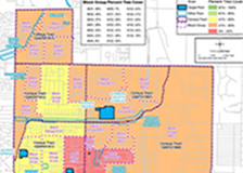
| Prioritizing Tree Planting in Durham, NC
|

| Using EnviroAtlas to Identify Locations for Urban Heat Island AbatementExcessive heat can be dangerous to human health. Planting trees and other vegetation in cities is a nature-based solution that can help reduce urban heat islands. This example explores one solution for minimizing the negative impacts of excessive summer heat due to urbanization in Portland, OR. [PDF, 2017] |
| Using EnviroAtlas in a Health Impact Assessment (HIA) |

| Managing Clean Air with Roadway Tree BuffersThis example shows how EnviroAtlas may be used to identify residential populations that are vulnerable to the negative health impacts of roadway air pollution. [Story Map, 2015] |
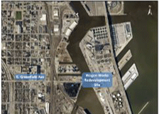
| Integrating Local Green Assets into Brownfields Redevelopment |

| Identifying Cost-effective Locations for Manure Management IncentivesThis use case explores one solution for minimizing the negative impacts of excess manure application in the Chesapeake Bay watershed using EnviroAtlas data. [PDF, 2017] |
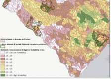
| Wetlands compensatory mitigation of lands prioritized for protection adjacent to Forest Service-owned landsThis use case explores a method for evaluating properties prioritized for protection (e.g., private inholdings and properties adjacent to National Forest System lands) for compatibility with wetland compensatory mitigation. [PDF, 2017] |

| Evaluating sites for an agricultural wetlands mitigation bank in IllinoisThis use case explores a method for evaluating potential sites for agricultural wetland mitigation banking under the National Resource Conservation Service (NRCS) wetland mitigation banking program. [PDF, 2017] |
Other Examples from the EnviroAtlas Community
Explore some of the projects and planning documents from communities that have used EnviroAtlas resources.
The following links exit the site:
- Benefits of Urban Trees in Birmingham, Alabama (University of Alabama at Birmingham: Lister Hill Center for Health Policy)
- Ecosystem Services Mapping in the Southeast (Duke University: Nicholas School of the Environment & National Ecosystem Services Partnership)
- Calumet River Communities Planning Framework: South Chicago, East Side, and South Deering
- Milwaukee, Wisconsin Outdoor Recreation Plan
- Milwaukee, Wisconsin Green Infrastructure Project
- The Resource Conservation Functional Master Plan: Planning for Human and Environmental Health (Prince George's County, Maryland)
- San Luis Obispo Creek Stormwater Resource Plan (San Luis Obispo, California)
Links to websites outside the EPA website are provided for the convenience of the user. Inclusion of information about a website, an organization, a product or a service does not represent endorsement or approval by EPA, nor does it represent EPA opinion, policy or guidance unless specifically indicated. EPA does not exercise any editorial control over the information that may be found at any non-EPA website.