U.S. flag

An official website of the United States government

Here’s how you know

Dot gov

Official websites use .gov
A .gov website belongs to an official government organization in the United States.

HTTPS

Secure .gov websites use HTTPS
A lock (LockA locked padlock) or https:// means you’ve safely connected to the .gov website. Share sensitive information only on official, secure websites.

    • Environmental Topics
    • Air
    • Bed Bugs
    • Cancer
    • Chemicals, Toxics, and Pesticide
    • Emergency Response
    • Environmental Information by Location
    • Health
    • Land, Waste, and Cleanup
    • Lead
    • Mold
    • Radon
    • Research
    • Science Topics
    • Water Topics
    • A-Z Topic Index
    • Laws & Regulations
    • By Business Sector
    • By Topic
    • Compliance
    • Enforcement
    • Laws and Executive Orders
    • Regulations
    • Report a Violation
    • Environmental Violations
    • Fraud, Waste or Abuse
    • About EPA
    • Our Mission and What We Do
    • Headquarters Offices
    • Regional Offices
    • Labs and Research Centers
    • Planning, Budget, and Results
    • Organization Chart
    • EPA History

Breadcrumb

  1. Home
  2. High-End Scientific Computing

Estuary Data Mapper (EDM)

Download Estuary Data Mapper
Estuary Data Mapper update released on March 5, 2025.  Read more about it.

You can download the EDM application for Mac, Windows, and Linux systems.

For help with downloading or program specifics, contact edm@epa.gov.

EDM's Release History details the datasets added in each EDM version.

With around 2,000 estuaries along the five US coastal regions (Atlantic, Gulf of Mexico, Pacific, Alaska, and Hawaii), scientists in many agencies and organizations have collected enormous amounts of current and historic data on estuary conditions.

An ongoing challenge is to pull that disparate information together to help estuary managers make informed decisions on protecting and preserving these unique environments.

EPA’s Estuary Data Mapper (EDM) helps researchers and estuary managers do just that.  The application provides a fast, easy way for researchers to zoom into a specific estuary of interest and find current, available data—from many sources—for that system.

The Estuary Data Mapper provides:
  • Inputs to a Geographic Information System-based data model for estuaries and their watersheds.
  • Data for tools and model outputs to assess, visualize, diagnose, predict, prioritize, and manage condition of estuaries and coastal watersheds.
  • A wealth of environmental data such as tidal, hydrologic, weather, water quality, and sediment quality.
  • Ground, satellite, air, and water data from EPA, the National Aeronautics and Space Administration (NASA), the National Oceanic and Atmospheric Administration (NOAA), and the US Geological Survey’s National Water Information System (NWIS). 
EDM provides a variety of data and visualization capabilities that can be used by:
  • Environmental scientists (aquatic biologists and chemists)
  • Water ecosystem managers
  • Non-governmental organizations and citizen groups focused on water ecosystems
Image of modelled meteorology/hydrodynamics data

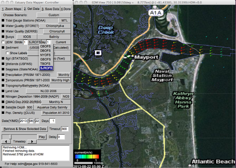
EDM also includes information about coastal rivers, tributaries, and watersheds. It gives users the ability to display background information, such as cities and roads, to help them explore areas of interest and learn more about the context. This data can help researchers gauge the status of estuary environments and possible threats—facilitating the use of decision-support tools to help them visualize the effects of potential management actions. For example, having access to nitrogen loading sources and predictive models of seagrass habitat can help communities and watershed organizations research ways to reduce nitrogen loads.

EDM contains data sources on atmospheric deposition, nonpoint and point nitrogen sources, and nitrogen loads to estuaries and their associated watersheds. EPA researchers will continue to incorporate new data resources and update the mapper to help protect these vital, productive ecosystems.

High-End Scientific Computing

  • RSIG
    • Download
    • RSIG3D Release History
    • RSIG3D Video Demonstrations
    • Web Access to RSIG Data
    • Reading Local/Remote CMAQ Files
    • Data Inventory
    • RSIG-Related Downloadable Data Files
    • How RSIG Regrids Data
    • Troubleshooting RSIG
  • EDM
    • About Estuary Data Mapper
    • Download & Install
    • Image Gallery
    • Release History
    • Data Inventory
    • Frequent Questions
    • Special Topics and Videos
      • EDM Basics
      • Nitrogen Sources and Loads
      • Develop Seagrass Models
      • Seagrass Updates (2024)
      • Web Coverage Service (WCS)
      • WCS & Decision Support Tools
      • Land-Use Scenarios
  • RETIGO
    • Enter Your Data in RETIGO
    • Timestamp Converter
    • Tutorial: How to use RETIGO
    • Tutorial: Create RETIGO file from Excel
    • Frequent Questions
Contact Us About High-End Scientific Computing
Contact Us to ask a question, provide feedback, or report a problem.
Last updated on March 5, 2025
  • Assistance
  • Spanish
  • Arabic
  • Chinese (simplified)
  • Chinese (traditional)
  • French
  • Haitian Creole
  • Korean
  • Portuguese
  • Russian
  • Tagalog
  • Vietnamese
United States Environmental Protection Agency

Discover.

  • Accessibility Statement
  • Budget & Performance
  • Contracting
  • EPA www Web Snapshot
  • Grants
  • No FEAR Act Data
  • Plain Writing
  • Privacy
  • Privacy and Security Notice

Connect.

  • Data
  • Inspector General
  • Jobs
  • Newsroom
  • Regulations.gov
  • Subscribe
  • USA.gov
  • White House

Ask.

  • Contact EPA
  • EPA Disclaimers
  • Hotlines
  • FOIA Requests
  • Frequent Questions
  • Site Feedback

Follow.