
Regional Monitoring Networks - Lakes
Lake RMNs
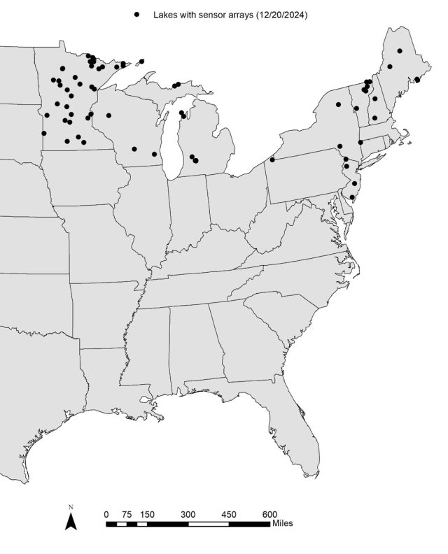
Lake RMNs exist for freshwater inland lakes in the Northeast (EPA Regions 1 and 2) and the Great Lakes Region (EPA Region 5; figure 1). Partners include states, tribes, the National Park Service (NPS), the U.S. Forest Service (USFS), and the Global Lake Ecological Observatory Network (GLEON). These lake RMN sites are coordinated with the National Lake Assessment (NLA) where possible. RMN data uses are described on the About page.
RMNs build on and supplement existing monitoring efforts. The main elements that make the RMNs unique are their focus on:
- High frequency data collection over a long duration
- Collection of thermal and hydrological data in addition to more ‘traditional’ water quality measures such as water chemistry and biology
- A flexible structure that allows entities to participate at different levels of effort, using regional protocols
Monitoring sites for Lake RMNs in a region should have similar environmental and biological characteristics and be sampled annually for 10 or more years, using comparable methods. The number of sites sampled by each participating entity varies. RMN partners have developed lists of recommended indicators and protocols, which are described in field guides, instructions, and a Quality Assurance Project Plan (QAPP).
The RMN framework is flexible to maximize participation and account for differing levels of resources and expertise among RMN partners. Some RMN partners, like the Minnesota Department of Natural Resources (MN DNR) and the Minnesota Pollution Control Agency (MPCA), have been collecting many of the recommended RMN indicators for decades. Other lake RMN partners are just getting started.
Lake protocols
The use of consistent and comparable methods at RMN sites is very important, because different methods can introduce biases in results and contribute to variability. Variation introduced by methodological differences in sampling and measurement can obscure trends over time by adding ‘noise’ to the data. Added noise requires longer periods of data collection to detect trends over time or more samples in a region to detect spatial trends. We strive to achieve as much consistency within and across RMN regions as possible.
The following protocol documents for data collection of recommended parameters are available:
- Secchi depth
- vertical water temperature profile
- water chemistry (grab samples)
- ice cover
- water level
- general assessment measures
- Protocols documents
The protocol documents include sections on:
- rational for collecting the parameter,
- the three levels of participation: 'minimum', 'target', and 'better',
- sampling and measurement protocols,
- basic equipment needs, considerations, and estimated costs,
- data recording requirements (what to include on field forms),
- data management,
- other helpful resources.
Lake site selection criteria
Sampling efforts for lake RMNs focus on sites where as many of the recommended data as possible can be collected using the RMN protocols. Figure 1 shows the locations of current Lake RMN sites.
Where feasible, sites should have as many of the desired characteristics listed in Table 1 as possible. The current screening process makes use of the Lake-Catchment (LakeCat) Dataset (Hill et al. 2018).
One of the characteristics is level of anthropogenic disturbance. In many regions, participants initially target minimally disturbed or ‘reference’ systems. Reference sites have long served as a standard against which to assess other waterbodies. Data from reference sites will help RMNs assess shifts in the 'baselines' used for assessing other lakes in the same RMN.
Another criterion in Table 1 is broad-scale classification. Classification serves several important purposes. First, it ensures that everyone is using a common language and has a clear understanding of what types of lakes are sampled. From an analytical standpoint, it can be an important consideration in site selection as well. Depending on goals of the RMN, some may select sites with similar environmental and biological characteristics to minimize natural variability across sites. Reduced variability improves statistical power of comparisons and our ability to detect long-term trends. Variables for lake classification include size (lake surface area), mixing pattern, trophic status, color, temperature, alkalinity, hydrologic source (seepage, drainage, spring) and degree of alteration (natural, unregulated vs. manmade, regulated).
The regional working groups are particularly interested in clear, deep lakes due to their expected vulnerability to surface warming and strong thermal stratification (Richardson et al. 2017). Oligotrophic lakes (where present) are also of high interest, particularly changes in total phosphorous (TP). Increased TP levels in lakes in relatively undisturbed catchments is likely to shift aquatic life community assemblages from oligotrophic to mesotrophic. Changes in fish communities are of particular concern.
Managing both discrete and continuous data collected from RMN sites is similar across the different types of RMNs and is described on a separate Data Management page. The Data Analysis page describes how RMN data are analyzed, summarized, and visualized to explore a variety of endpoints.
Leveraging Collaborations
Ongoing lake monitoring activities dovetail with some RMN sites and activities. Some examples include:
- Coordination of sites and protocols with the National Lake Assessment (NLA) where feasible
- Collaboration with the Global Lake Ecological Observatory Network (GLEON)
- Lake Observer website and software application
- Share experience with continuous sensors and data
- Lake Analyzer - software and model developments