
Water Research Outputs
EPA’s Office of Research and Development delivers research necessary to support EPA’s overall mission to protect human health and the environment. Our water research provides the science, tools, and technologies needed for innovatively and economically supporting safe and adequate supplies of water and protecting people’s health and livelihood while restoring and maintaining watersheds and aquatic ecosystems.
Analytical Methods
- Collection of Environmental Methods. EPA offices and laboratories, and outside organizations, have developed approved methods for measuring the concentration of a substance or pollutant.
- Drinking Water Research Methods. Residues of unregulated contaminants may be present in drinking water. However, little is known about their prevalence in the environment. To protect human health, EPA scientists have developed a number of EPA methods to detect unregulated contaminants.
- PFAS Analytical Methods Development and Sampling. EPA scientists are developing validated analytical methods for drinking water; groundwater; surface water; wastewater; and solids, including soils, sediments, biota, and biosolids, which may eventually become standard methods or research methods. Visit EPA's status of PFAS research and development webpage to get updates about this and other PFAS research.
-
Methods to Measure Waterborne Contaminants Research to Minimize Health Risks. EPA researchers have been developing and evaluating effective tools to measure waterborne contaminants, which are essential for determining the risks these pollutants pose to people and the environment. With these tools, the source and level of contaminants can be evaluated, the risk posed to exposed communities can be characterized, and approaches for improving affected water resources can be developed.
Models and Tools
-
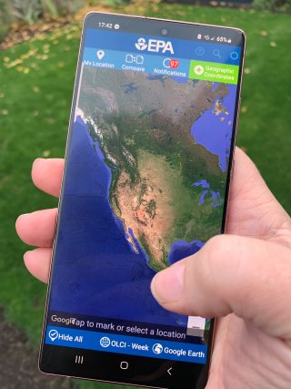
EPA's Cyanobacteria Assessment Network app (CyAN app), which provides access to cyanobacterial bloom satellite data for over 2,000 of the largest lakes and reservoirs across the United States. - Water Sensors Toolbox. This toolkit is a collection of resources and information related to EPA research that uses, evaluates, and/or develops water sensors―including remote sensors and related data management technology. These resources may be useful to students, researchers, citizen scientists, water quality decision makers, or others interested in collecting data on water quality with the use of water sensors.
- Green Infrastructure Modeling Toolkit. The resources in this toolkit include innovative models, tools, and technologies for communities to manage water runoff in urban and other environments. They incorporate green or a combination of green and gray infrastructure practices to help communities manage their water resources in a more sustainable way, increasing resilience to future changes.
- Environmental Modeling Community of Practice. This site provides a collection of groundwater, food chain, total maximum daily load, surface water, and multimedia models and tools.
- Contacts for Models, Tools, and Databases. This webform provides the contacts and emails for all freely available water-related models, tools, and databases.
EPA Models, Tools, and Resources for Water Research
| Name and Link | Description |
|---|---|
|
3DFATMIC (Three-Dimensional Subsurface Flow, Fate and Transport of Microbes and Chemicals) |
This model simulates subsurface flow, fate and transport of contaminants that are undergoing chemical or biological transformations. |
|
3DFEMWATER/3DFEMDLEWASTE (Three-Dimensional Finite Element Model of Water Flow Through Saturated-Unsaturated Media and Three-Dimensional Lagrangian-Eulerian Finite Element Model of Waste Transport Through Saturated-Unsaturated Media Models) |
3DFEMWATER and 3DLEWASTE are related and can be used together to model flow and transport in three dimensional, variably saturated porous media under transient conditions with multiple distributed and point sources/sinks. These models should be used by experienced numerical modelers with strong background in hydrogeology. |
|
The AGWA tool is a geographic information systems (GIS) interface designed to help manage and analyze watershed water quantity and quality. |
|
|
AQUATOX is a simulation model for aquatic systems. AQUATOX predicts the fate of various pollutants, such as nutrients and organic chemicals, and their effects on the ecosystem, including fish, invertebrates, and aquatic plants. |
|
|
BASINS (Better Assessment Science Integrating point & Non-point Sources) |
BASINS is a multipurpose environmental analysis system designed to help regional, state, and local agencies perform watershed- and water quality-based studies. It can assist in watershed management and TMDL development by integrating environmental data, analysis tools, and watershed and water quality models. |
|
BASS is a model that simulates the population and bioaccumulation dynamics of age-structured fish communities. Although BASS was specifically developed to investigate the bioaccumulation of chemical pollutants within a community or ecosystem context, it can also be used to explore population and community dynamics of fish assemblages that are exposed to a variety of nonchemical stressors such as altered thermal regimes associated with hydrological alterations or industrial activities, commercial or sports fisheries, and introductions of non-native or exotic fish species. |
|
|
BIOCHLOR is a screening model that simulates remediation by natural attenuation of dissolved solvents at chlorinated solvent release sites. |
|
|
BIOPLUME III is a two-dimensional contaminant transport model for use under the influence of oxygen, nitrate, iron, sulfate, and methanogenic biodegradation. |
|
|
BIOSCREEN is a screening model that simulates remediation through natural attenuation of dissolved hydrocarbons at petroleum fuel release sites. The model is designed to simulate biodegradation by both aerobic and anaerobic reactions. |
|
|
Breakpoint Chlorination Simulator for Drinking Water Systems; |
Two web-based applications are presented to (1) simulate inorganic chloramine formation and stability, including a basic inorganic chloramine demand reaction for organic matter and (2) generate chlorine breakpoint curves. |
|
CADDIS (Causal Analysis/Diagnosis Decision Information System) |
CADDIS is designed to help scientists and resource managers in the regions, states, and Tribes conduct causal assessments in aquatic systems. It provides a weight-of-evidence approach for identifying causes of biological impairment (Volume 1), along with information, examples, and tools to help with this process (Volumes 2-5). |
|
CANARY-EDS (Continuous Analysis of Networked Array of Sensors for Event Detection) |
The CANARY event detection software was developed to enhance the detection of contaminants in drinking water. Many drinking water utilities collect real-time data from sensors located throughout the water distribution network. The sensors measure water quality parameters such as pH, residual chlorine, total organic carbon, and specific conductance. CANARY analyzes these data rapidly to identify anomalous or abnormal periods of water quality that might indicate contamination incidents. |
|
CHEMFLO™-2000, Software for Simulating Water and Chemical Movement in Unsaturated Soils |
CHEMFLO-2000 enables users to simulate water movement and chemical fate and transport in vadose zones. |
|
Chloramine Formation and Decay Simulator for Drinking Water Systems |
This application provides two side-by-side simulations (A and B) and associated graphs to allow comparison of input choices on chloramine formation and decay. |
| This tool will help consumers select point-of-use (POU) and pitcher filters that have been evaluated by an accredited third-party certification body for drinking water lead (Pb) reduction to 5 parts per billion (ppb) or less and particulate reduction (Class I) capabilities against both NSF/ANSI Standards 53 and 42. | |
|
CZAEM is a single-layer model for simulating steady flow in homogeneous aquifers using the Analytic Element Method. It serves as a tool in the wellhead protection decision making process by delineating groundwater capture zones and isochrones of residence times. |
|
|
Cyanobacteria Assessment Network Mobile Application (CyAN app and CyANWeb) |
CyANWeb is an easy-to-use and customizable app that provides access to cyanobacterial bloom satellite data for over 2,000 of the largest lakes and reservoirs across the United States. |
|
TDB presents referenced information on the control of contaminants in drinking water. It provides users with current information on more than 30 treatment processes and over 120 regulated and unregulated contaminants, including 26 PFAS chemicals. |
|
|
EPA developed several engineering models using a bottom-up approach known as work breakdown structure (WBS). The WBS models derive system-level costs and provide EPA with comprehensive, flexible and transparent tools to help estimate treatment costs. |
|
|
EDM helps researchers and estuary managers do just that. The application provides a fast, easy way for researchers to zoom into a specific estuary of interest and find current, available data—from many sources—for that system. |
|
|
EFDC) is a multifunctional surface water modeling system, which includes hydrodynamic, sediment-contaminant, and eutrophication components. |
|
|
ETDOT is a suite of software models that provides engineers with the capability to evaluate and design systems that use granular activated carbon or ion exchange resins for the removal of contaminants, including PFAS, from drinking water and wastewater. |
|
|
ExpoBox is a toolbox that helps people assess environmental exposure to harmful chemicals and pathogens. |
|
|
EPANET (all versions) |
EPANET is a software application used to model water distribution systems. Engineers and consultants use EPANET to design and size new water infrastructure, retrofit existing aging infrastructure, optimize operations of tanks and pumps, reduce energy usage, investigate water quality problems, and prepare for emergencies. |
|
EPA H2O is a GIS-based decision support tool for assessing the provision of ecosystem services under different land use scenarios. |
|
|
EXAMS is an interactive software application for formulating aquatic ecosystem models and rapidly evaluating the fate, transport, and exposure concentrations of synthetic organic chemicals including pesticides, industrial materials, and leachates from disposal sites. |
|
|
The initial Green Ampt model was the first physically based model/equation describing the infiltration of water into soil. It has been the subject of considerable development in soil physics and hydrology, owing to its simplicity and satisfactory performance for a great variety of water infiltration problems. This model yields cumulative infiltration and the infiltration rate as an implicit function of time. |
|
| FOOTPRINT |
FOOTPRINT is a simple, user-friendly screening model used to estimate the length and surface area of benzene, toluene, ethylbenzene, and xylene (BTEX) plumes in groundwater, produced from a gasoline spill that contains ethanol. The primary objective of the software is to predict the increase in surface area of the plume of BTEX compounds or any other chemical of concern (COC) due to the presence of ethanol in groundwater. |
|
This application is designed to simulate the free chlorine in systems adding free chlorine and cyanuric acid, including the application of Dichlor and Trichlor. It Drinking water practitioners (e.g., operators, regulators, engineers, professors, and students) can use the tool to explore the water chemistry of the free chlorine and cyanuric acid system and to estimate free chlorine concentrations. |
|
|
Freshwater Explorer is an interactive web-based mapping tool for water quality parameters of freshwater streams, lakes, and groundwater wells in all 50 U.S. states, Puerto Rico, and the U.S. Virgin Islands. |
|
|
GCSolar is desktop program that computes direct photolysis rates and half-lives of pollutants in the aquatic environment. The half-lives are calculated as a function of season, latitude, time-of-day, depth in water bodies, and ozone layer thickness. |
|
|
The database displays sites where the performance of BMPs and low impact development approaches for controlling stormwater runoff have been monitored and reported on. |
|
|
GIWiz offers a repository of EPA-sourced Green Infrastructure tools and resources designed to support and promote sustainable water management and community planning decisions. |
|
|
The GCX website includes tools, data, and guidance that are useful for evaluating the vulnerability of air, water, ecosystems, and human health in relation to climate change, land use change, and other large-scale environmental stressors. |
|
|
The resources in this toolkit incorporate green or a combination of green and gray infrastructure practices to help communities manage their water resources in a more sustainable way, increasing resilience to future changes. |
|
|
The HELP V 4.0 model is a quasi-two-dimensional hydrologic model of water movement across, into, through and out of landfills. |
|
|
How to Identify Lead Free Certification Marks for Drinking Water System and Plumbing Products |
In the United States, there are currently eight American National Standards Institute accredited third-party certification bodies that provide product certification to the Safe Drinking Water Act lead free requirement for manufacturers of pipes, fittings, fixtures, solder, and flux used for drinking water. Each of these certification bodies has unique certification marks (registered trademarks) that they use to certify a multitude of drinking water products for various requirements. This factsheet provides detailed information to navigate certification marks. |
|
HSCTM2D (Hydrodynamic, Sediment, and Contaminant Transport Model) |
The HSCTM2D is a finite element modeling system for simulating two-dimensional, vertically-integrated, surface water flow (typically riverine or estuarine hydrodynamics), sediment transport, and contaminant transport. |
|
HSSM simulates flow of the light nonaqueous-phase liquid (LNAPL) and transport of a chemical constituent of the LNAPL from the surface to the water table; radial spreading of the LNAPL at the water table, and dissolution and aquifer transport of the chemical constituent. |
|
|
The Integrated Climate and Land Use Scenarios (ICLUS) project produced spatially explicit projections of population and land-use that are based on Intergovernmental Panel on Climate Change’s (IPCC) scenarios and pathways. |
|
| Point-of-use (POU) filters — or a water treatment system used at a single faucet or other fixture — are a relatively inexpensive treatment for reducing PFAS in the home. This webpage helps people begin identifying the right water filter for their home. | |
|
LakeCat currently contains over 300 metrics that include local catchment, watershed, and special metrics. These metrics are available for 378,088 lakes and their associated catchments across the conterminous US. LakeCat metrics represent both natural (e.g., soils and geology) and anthropogenic (e.g, urban areas and agriculture) landscape information. |
|
|
The Green Ampt model has been modified in this application to calculate water infiltration into non-uniform soils by several researchers. Specifically, the model could be used for the determination of water infiltration over time in vertically heterogeneous soils. |
|
|
MINTEQA2 is a equilibrium speciation model that can be used to calculate the equilibrium composition of dilute aqueous solutions in the laboratory or in natural aqueous systems. |
|
|
MOFAT is a two-dimensional, finite element model for simulating coupled multiphase flow and multi-component transport in planar or radically symmetric vertical sections. |
|
|
MPN Calculator was developed for bacteriologists to estimate microorganisms in a sample by computing the MPN value estimate using probability formulas. The calculator was developed to help public drinking water utilities monitor their water for bacterial indicators and pathogens. Subsequently, it was modified to provide MPN calculations for viral contaminants. |
|
|
MULTIMED simulates the movement of contaminants leaching from a waste disposal facility. The model consists of a number of modules which predict concentrations at a receptor due to transport in the subsurface, surface air, or air. |
|
|
NAPL Simulator conducts a simulation of the contamination of soils and aquifers that results from the release of organic liquids commonly referred to as nonaqueous-phase liquids. |
|
|
This report presents the results from building a database to document the performance of rehabilitation technologies on a national basis including additional cured-in-place pipe liner testing, testing of three other types of rehabilitation technologies (sliplining, fold-and-form, and deform-reform), and a review of the overall experiences with sewer rehabilitation technologies. |
|
|
OWL is a simple tool to evaluate existing monitoring well networks and assist in the selection of new monitoring well locations. |
|
|
The PESTAN model is a computer code for estimating the transport of organic solutes through soil to groundwater. |
|
|
The Philip's Two-Term model (PHILIP2T) is a truncated power series solution developed by Philips (1957). |
|
| Plumbing Volume Estimator Tool | The Plumbing Volume Estimator Tool allows users to generate a plumbing map for a home or building. A plumbing map includes all the various plumbing materials in a home or building along a specific water flow route. |
|
PRZM3 is the most recent version of a modeling system that links two subordinate models, PRZM and VADOFT, in order to predict pesticide transport and transformation down through the crop root and unsaturated zone. |
|
|
QTRACER2, designed to run on PCs running any version of Microsoft Windows, was developed to facilitate tracer-breakthrough curve analysis. It solves the necessary equations from user-generated data input files using robust integration routines and relies on established hydraulic models. |
|
|
One-dimensional river and stream water quality model with steady state hydraulics, non-uniform steady flow, and diel heat budget/water-quality kinetics. |
|
|
The RBI Approach is an easy-to-use process for assessing restoration sites using non-monetary benefit indicators. It uses readily available data to estimate and quantify benefits to people around an ecological restoration site. |
|
|
REMChlor (Remediation Evaluation Model for Chlorinated Solvents) |
REMChlor is an analytical solution for simulating the transient effects of groundwater source and plume remediation. |
|
REMFuel (Remediation Evaluation Model for Fuel Hydrocarbons) |
REMFuel simulates the transient effects of groundwater source and plume remediation for fuel hydrocarbons. |
|
SERAFM (Spreadsheet-based Ecological Risk Assessment for the Fate of Mercury) Conceptual Model |
SERAFM is a process-based, steady-state modeling system based in a spreadsheet framework incorporating a series of process modules. SERAFM predicts speciated mercury concentrations (Hg0, HgII, MeHg, HgT) in water (filtered and unfiltered) and sediments, and total mercury concentrations in fish tissue. |
|
SHEDS (Stochastic Human Exposure and Dose Simulation) Models |
The SHEDS models are probabilistic models that can estimate exposures people face from chemicals encountered in everyday activities. The models are able to generate predictions of aggregate and cumulative exposures over time to inform risk assessments that protect human health. |
|
SSOAP (Sanitary Sewer Overflow Analysis and Planning) Toolbox |
The SSOAP toolbox is a suite of computer software tools used for the quantification of rainfall-derived infiltration and inflow and help capacity analysis and condition assessment of sanitary sewer systems. |
|
Stable Isotope Mixing Models for Estimating Source Proportions |
Stable isotope analysis can be used in ecological studies to trace chemical movement through the environment. A common application is to use the isotopic composition of a mixture to determine the proportions of various sources in the mixture, using mathematical mixing models. |
|
StreamCat currently contains over 600 metrics that include local catchment, watershed, and other special metrics. |
|
|
SUSTAIN (System for Urban Stormwater Treatment and Analysis Integration) |
SUSTAIN is a decision support system that assists stormwater management professionals with developing and implementing plans for flow and pollution control measures to protect source waters and meet water quality goals. SUSTAIN allows watershed and stormwater practitioners to develop, evaluate, and select optimal best management practice (BMP) combinations at various watershed scales based on cost and effectiveness. |
|
SWC is a web-based application tool that estimates the annual amount of rainwater and frequency of runoff from a specific site using green infrastructure as low impact development controls. The SWC is designed for use by anyone interested in reducing runoff from a property, including site developers, landscape architects, urban planners, and homeowners. |
|
|
SWMM is used for decision support, emergency response, planning, analysis, and design related to stormwater, combined, and sanitary sewer systems as well as for other drainage systems. It can be used to evaluate gray infrastructure stormwater control strategies, such as pipes and storm drains, and is a useful tool for creating cost-effective hybrid green/gray stormwater control solutions. SWMM was developed to help support local, state, and national stormwater management objectives to reduce runoff through infiltration and retention and help to reduce discharges that cause impairment to receiving waterbodies. |
|
|
TEVA-SPOT is used by water utilities to optimize the number and location of contamination detection sensors so that economic and/or public health consequences are minimized. |
|
|
The ToxCast program makes in vitro medium- and high-throughput screening assay data publicly available for prioritization and hazard characterization of thousands of chemicals. |
|
|
The Traits Database currently contains traits data for 3,857 North American macroinvertebrate taxa, and includes habitat, life history, mobility, morphology and ecological trait data. |
|
|
The UEV Library assesses resource use in elementary flows and storages. It provides the emergy per unit values to quantify the environmental support associated with elementary resource use in emergy accounting, lifecycle analysis (LCA) studies, and sustainability metrics. |
|
| VB (Virtual Beach) |
Virtual Beach is a software package designed for developing site-specific statistical models for the prediction of pathogen indicator levels at recreational beaches. |
|
VELMA (Visualizing Ecosystem Land Management Assessments) Model |
VELMA is a tool designed to model effective decisions for a wide array of environmental issues. It is a spatially explicit ecohydrological watershed model that planners can use to visualize the effects of their decisions. VELMA can be used to make better use of both natural and engineered green infrastructure (GI) to control loadings from point and nonpoint sources of pollution. VELMA was designed for use by communities, land managers, policy makers, scientists and engineers. |
|
Virulo is a user-friendly screening model that generates simulations of how physical, biological, and chemical factors might alter viruses so they become harmless or immobilized. Virulo was designed to help state regulators, utilities, and development planners with their understanding of the fate and transport of viruses in unsaturated soils. |
|
|
VLEACH Model is a one-dimensional, finite difference model for making preliminary assessments of the effects on groundwater from the leaching of volatile, sorbed contaminants through the vadose zone. |
|
|
PLUMES2.0 builds on the previous work in VISUAL PLUMES, providing a publicly available, open source, plume model. PLUMES2.0 provides concentrations for (1) initial dilution phase dilution (near-field) and (2) Brook's far-field. |
|
|
WASP helps users interpret and predict water quality responses to natural phenomena and manmade pollution for various pollution management decisions. |
|
|
WATERSHEDSS (Water, Soil, and Hydro-Environmental Decision Support System) |
WATERSHEDSS was developed to assist managers of predominantly agricultural watersheds in defining water quality problems and selecting appropriate nonpoint source (NPS) pollution control measures. |
|
Weight-of-Evidence Methods for Transparent and Defensible Numeric Nutrient Criteria Report |
This report complements existing numeric nutrient guidance and support to states by discussing weight-of-evidence (WoE) methods that enable rigorous and transparent development and integration of multiple lines of evidence. |
|
WhAEM for Windows, is a groundwater geohydrology computer program. WhAEM is a ground-water flow model designed to facilitate capture zone delineation and protection area mapping in support of the Wellhead Protection Programs (WHPP) and Source Water Assessment Planning (SWAP) for public water supplies in the United States. |
|
|
WHATIF (Watershed Health Assessment Tools Investigating Fisheries) |
WHATIF is software that integrates a number of calculators, tools, and models for assessing the health of watersheds and streams with an emphasis on fish communities in the Mid-Atlantic Highland region. The tool set consists of hydrologic and stream geometry calculators, a fish assemblage predictor, a fish habitat suitability calculator, macro-invertebrate biodiversity calculators, and a process-based model to predict biomass dynamics of stream biota (the BASS model). |
|
WHPA is a semi-analytical groundwater flow simulation program used for delineating capture zones in a wellhead protection area. WHPA is applicable to homogeneous aquifers exhibiting two-dimensional, steady groundwater flow in an areal plane and appropriate for evaluating multiple aquifer types (i.e., confined, leaky-confined, and unconfined). |
|
| WMOST (Watershed Management Optimization Support Tool) |
WMOST is a decision support tool that facilitates integrated water management at the local or small watershed scale. WMOST models the environmental effects and costs of management decisions in a watershed context that is, accounting for the direct and indirect effects of decisions. The model considers water flows and water quality. |
Publications
Publication Databases
Science Inventory
A searchable database of research products primarily from EPA's Office of Research and Development.
National Service Center for Environmental Publications
A searchable database of Agency-wide technical, scientific, and educational materials.

The topics below provide quick links to water research-related products in EPA’s Science Inventory, which provides research products, such as journal articles, reports, fact sheets, and presentations, primarily from EPA’s Office of Research and Development. The entries provide product descriptions, contact information, and links to available online and printed material or websites.
All water research products in Science Inventory