
North Central Region: Skyline Mine
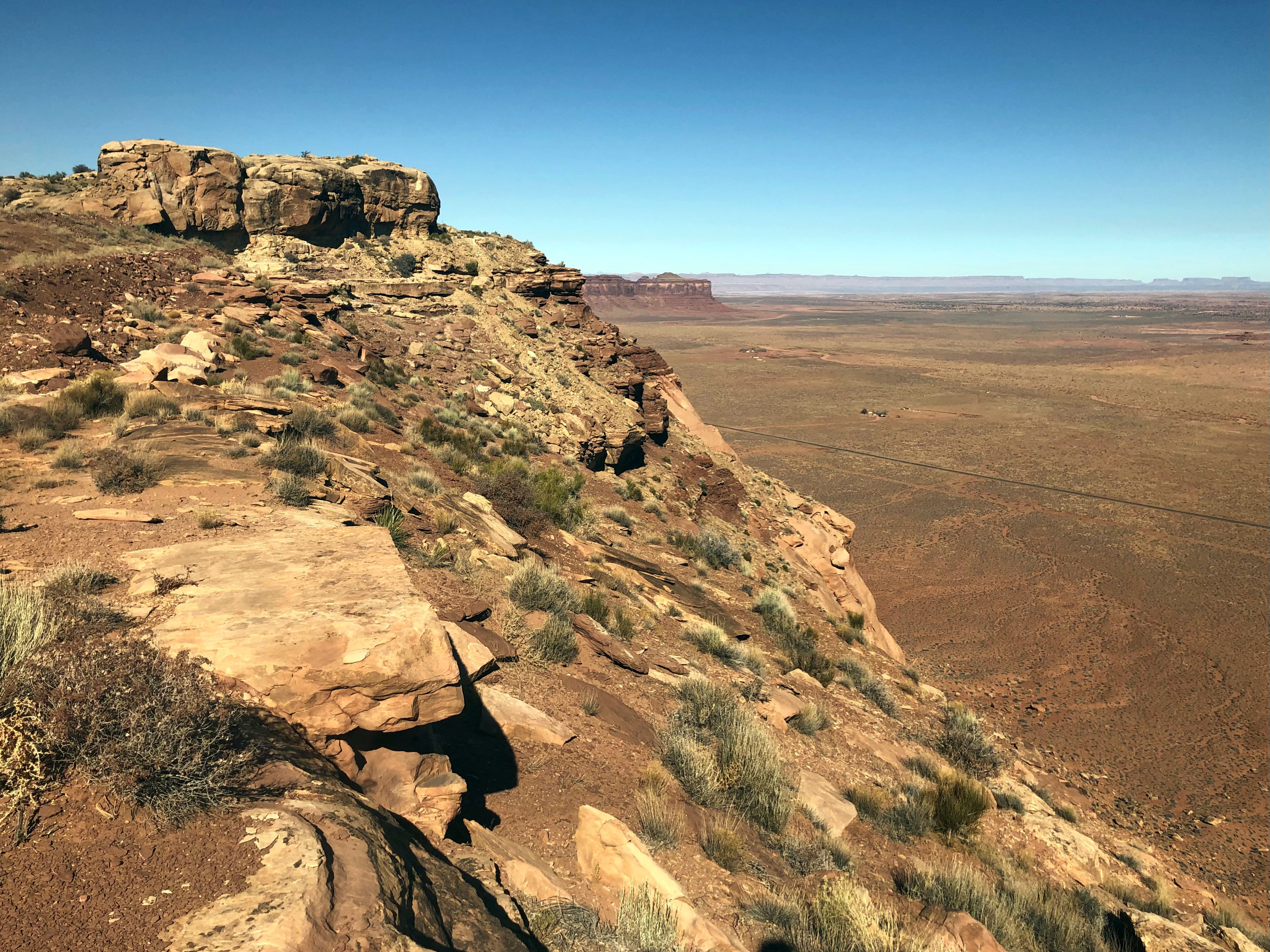
The Skyline mine is an abandoned uranium mine site located in the Oljato Chapter of the Navajo Nation in southeastern Utah. The site is located on top of Oljato Mesa which rises up to 400 feet above the surrounding land. The site is approximately 1.5 miles northwest of Gouldings, Utah.
Background | Site Facts | Timeline | Documents | Contacts | Progress | Photos
Background
Mine History
Mining occurred on the Utah No. 1 Lease from 1942 to 1946. In 1949, Utah No. 1 Lease was reacquired and expanded. The larger site was named Skyline Mine and was active until 1962. A gondola was constructed and used during mining operations to transport the ore to the bottom of the mesa.
In 2007, the site was deemed a priority mine by USEPA due to the proximity to residents. In 2010, a TCRA (time-critical removal action) was performed to address onsite mine waste. An onsite repository was built to contain the waste.
Currently EPA is assessing the site for any remaining waste and to determine a final remedy for cleanup.
Site Contacts
Remedial Project Manager
Amanda Townsend
townsend.amanda@epa.gov
(415) 972-3030
Community Involvement Coordinator
Elsa Johnson
johnson.elsa@epa.gov
(415) 947-3552
Field Work
Under the RAES contract, the USEPA began field work on the Skyline Mine in 2022. Field activities include:
- Biological and Cultural Resource Surveys
- Placing warning signs at the sites
- Removal Site Evaluation (RSE)
- Gamma radiation scanning
- Soil Sampling
- Surface water assessments
- Geologic assessment
Cleanup Progress Timeline
2023
In June 2023, EPA and Navajo EPA began the first phase of assessment work at Skyline Mine. The scoping survey is the first step in the Removal Site Evaluation which will ultimately provide a comprehensive data set for the site. The scoping survey includes gamma scanning, geologic mapping, and Background Study Area identification.
The scoping survey was followed by a characterization survey which includes soil sampling both onsite and in the background areas.
The Removal Site Evaluation for Skyline Mine is expected to be published by the end of the 2023 calendar year.
2022
Under the RAES contract, the USEPA began field work on the Skyline Mine in 2022.
2012
Weston Solutions Inc. completes a Screening Report of Skyline.
2011
USEPA conducted a TCRA to address contamination identified on the talus slope beneath the Skyline Mine. A geosynthetic material-lined repository was constructed near the top of Skyline Mine to hold mine waste and contaminated soils on the site.
Site Photographs
-
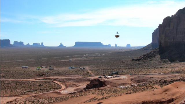
Gondola used during 2011 TCRA work.
-
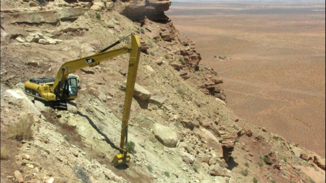
Excavator work during 2011 TCRA.
-
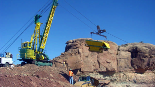
Gondola used during 2011 TCRA work.