
Tronox NE Churchrock Quivira Mines
The Tronox NE Churchrock Quivira Mines site includes three areas:
- the former Church Rock 1 (CR-1) mining area;
- the former Church Rock 1 East (CR-1E) mining area; and
- the Kerr-McGee Ponds area.
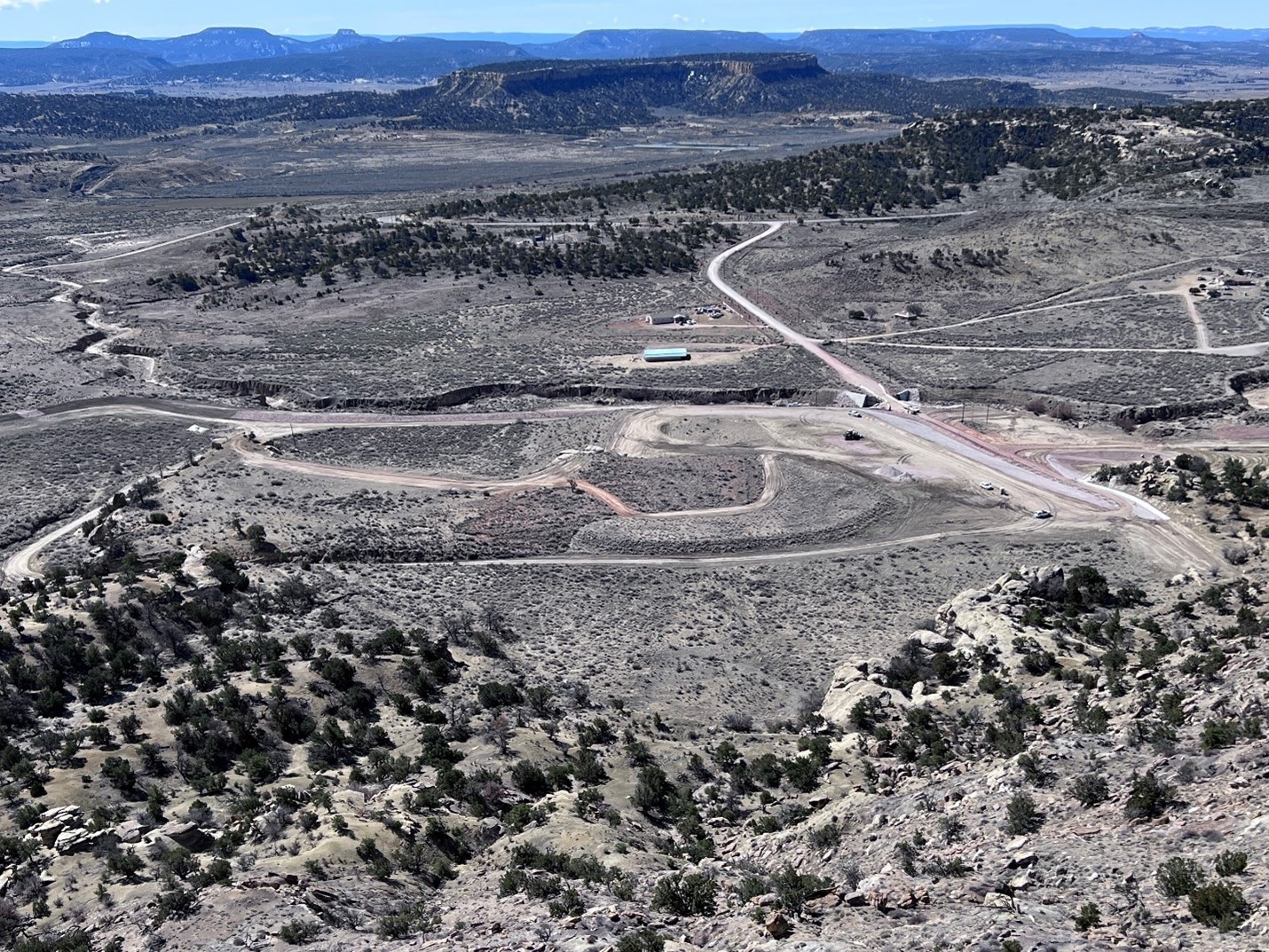
The site is located at the northern end of State Highway 566 approximately 20 miles northeast of Gallup, NM in the Coyote Canyon, Standing Rock, and Pinedale Chapters in the Eastern Abandoned Uranium Mine (AUM) Region of the Navajo Nation.
CR-1 and CR-1E include fenced areas around former mining operations, waste rock piles, and surrounding contaminated areas. CR-1 covers an area of 42 acres with 147 acres of underground workings and CR-1E 10.5 acres with 96 acres of underground workings. The Kerr-McGee Ponds area covers 9 acres and was a former solids dewatering and protore storage area.
The United States Environmental Protection Agency (EPA) is working with the Navajo Nation Environmental Protection Agency (NNEPA) to oversee investigation and cleanup at the mine areas while pursuing enforcement efforts with potentially responsible parties.
Background
The Quivira Mines site is an inactive uranium mine operation located northeast of Gallup, New Mexico. Commercial exploration, development, and mining of uranium at Quivira Mines began in the late 1960s by the Kerr-McGee Corporation (Kerr-McGee) and then its subsidiary, Kerr-McGee Nuclear. Kerr-McGee Nuclear later changed its name to the Quivira Mining Corporation which was later sold to the predecessor company of Rio Algom Mining, LLC.
Mining continued until 1986 resulting in recovery of an estimated 1.3 million tons of uranium ore from CR-1 and CR-1E mine areas. The mined uranium ore body is located approximately 1,500 to 1,800 feet below ground and accessed via vertical mine shafts at the CR-1 and CR-1E locations. A third mine shaft, Church Rock 2 (CR-2), was proposed and explored, but never developed. EPA completed a removal assessment for CR-2 in 2015, which found that CR-2 was not impacted by mining and does not require a response action.
The mine workings were within an aquifer containing groundwater and were therefore referred to as “wet mines”, which required ongoing dewatering during operations. Water was pumped from the underground mine workings and discharged to a series of as many as 7 treatment and settling ponds before being discharged to Unnamed Arroyo #2 and the Pipeline Arroyo. Ore was transported approximately 50 miles from the site to the Quivira Mining Corporation’s Ambrosia Lake uranium mill located to the east and north of Grants, New Mexico.
Cleanup Results to Date
Various mine reclamation, investigation, and removal activities were performed at the Quivira Mines since 1980. Quivira Mining Corporation performed reclamation and removal of debris while closing the CR-1 and CR-1E mines and Kerr-McGee Ponds between 1980 and 1992. EPA issued an Administrative Order on Consent to Rio Algom in 2010. Rio Algom conducted a Removal Site Evaluation in 2010 under direction of EPA. In 2010 and 2012 Rio Algom under direction of EPA and NNEPA performed temporary removal actions at CR-1 and Red Water Pond Road to consolidate waste and prevent migration and exposure. Cleanup of the Quivira Mines was included in the Tronox Settlement in 2014. In 2017, EPA investigated the Kerr-McGee Ponds and cleaned up soil around vent holes for the Quivira Mines underground workings. In 2022, EPA conducted a data gaps investigation at CR-1, CR-1E, and Kerr-McGee Ponds to gather additional data necessary to complete the Engineering Evaluation and Cost Analysis (EE/CA). In early 2024, EPA completed improvements to erosion and stormwater controls at CR-1 and grade improvements on Pipeline Road in support of upcoming removal actions.
Action Memorandum
EPA and NNEPA issued the final Quivira Mines site EE/CA report at a public meeting on March 23, 2024. This was followed by a 60-day Public Comment Period that ended on May 22, 2024. On January 6, 2025, EPA, in consultation with the Navajo Nation, finalized an Action Memorandum which selects a cleanup action to address the release of radionuclides and metals at the Quivira Mines site. The Action Memorandum incorporates EPA’s responses to public comments received on the EE/CA and addresses concerns raised by the Navajo Nation during government-to-government consultation.
Efforts leading to this decision sought to inform the communities’ understanding of EPA’s basis for the removal action and gain community acceptance, where possible. EPA’s plan includes removing uranium mine waste rock from the three areas at the Quivira Mines site mine areas and transporting it to a newly created off-site disposal repository located at the Red Rocks Landfill property. The new facility will be designed, permitted, and constructed at the Red Rocks Landfill property by the Northwest New Mexico Regional Solid Waste Authority near Thoreau, New Mexico. Including the time it will take to obtain permits and complete construction of the new disposal repository, the removal action is estimated to take 6-8 years to complete.
Next Steps: Design and Permitting
With the selection of a cleanup action in the Action Memorandum, EPA will start working with the Northwest Regional Solid Waste Authority to begin the process of submitting permit applications to the State of New Mexico for the Red Rocks Landfill mine waste rock disposal facility. The permitting process will include waste repository designs. The permitting process will take one to three years to complete.
Community Involvement
Community members have an opportunity to become involved in the cleanup activities and help shape cleanup decisions. EPA and NNEPA meet regularly, in coordination with chapter officials, with residents and other community members about work at the Quivira Mines site.
Who is the Community?
The community includes people in both rural areas and more urban areas around Gallup. Many people live and graze livestock near the Quivira Mines. The Quivira Mines are located on the Coyote Canyon, Standing Rock, and Pinedale Chapters and partially on United Nuclear Corporation lands. The local Navajo communities impacted by the Quivira Mines include the Red Water Pond Road and Pipeline Road.
EPA and NNEPA Current Involvement Activities
EPA and NNEPA work with community leaders such as the council delegates, chapter officials, grazing and land board officials, responsible company representatives, as well as community members for all outreach activities and information sessions. To keep the community informed, EPA and NNEPA have done the following:
- Developed fact sheets and flyers
- Conducted interviews for a Community Involvement Plan (CIP)
- Attend chapter meetings to share information on cleanup progress
- Held open house meetings and workshops to share and receive input on cleanup alternatives
EPA and NNEPA Past Community Involvement Activities
EPA and NNEPA completed the following activities in the community:
- Interviews for a Community Involvement Plan (CIP)
- Worked with chapter officials and family members to gain access to mine sites
- Attended local chapter meetings to share site investigation information
Partnerships
EPA and NNEPA continues to work and strengthen relationships with several organizations focused on uranium and radiation, including:
- Navajo Nation Abandoned Mine Lands Program
- Indian Health Service Community Uranium Exposure-Journey to Healing
- Indian Health Service Radiation Exposure Screening and Education Program
- Office of Navajo Uranium Workers
- Navajo Birth Cohort Study
- Navajo Nation Department of Health Community Health Representatives
- Bureau of Indian Affairs
- Indian Health Service
- Agency for Toxic Substances and Disease Registry
- Nuclear Regulatory Commission
- Department of Energy
- University of New Mexico
- Northern Arizona University
- Others as suggested by community members and local officials
Cleanup Progress Timeline
1980 to 1982: Reclamation of the Former Kerr-McGee Ponds on UNC Property
- Removed dewatering pond berms and former proto ore stockpile and grading to match the surrounding land.
- Estimated volume of contaminated soils at Kerr-McGee Ponds including the laydown yard, former ponds area, and former proto ore stockpile area is 45,000 cubic yards.
1985 or 1986: Reclamation of CR-1 and CR-1E Mines
- Removed mine equipment including mine dewatering pumps, hoists, compressors, headframes, and generators; buildings; and foundations.
- Scraped bottom of settling ponds and backfilling.
- Consolidated waste rock at one location at each site. The wastes (mainly waste rock and low-grade ore) were capped with 6 to 12 inches of soil.
- Estimated volume of waste at the CR-1 waste pile, former settling ponds, and industrial and step-out areas is 920,000 cubic yards.
- Estimated volume of waste at CR-1E waste piles, former pond, and industrial and step-out areas is 45,000 cubic yards.
2010: Time-Critical Removal Action for Erosion Controls, Roads, and Bridge
- Repaired fences, grade and seed the western slopes of the CR-1 waste pile. Install sediment control structures to CR-1.
- Repaired mine access roads and the Red Water Pond Road.
- Repaired the bridge crossing the arroyo near the CR-1 waste pile.
2012 Time-Critical Removal Action for Waste Removal from Road
- Excavated 17,374 cubic yards of contaminated soil, place excavated materials onto the waste rock stockpile at CR-1.
- Reconstructed Red Water Pond Road and shoulder area between State Road 566 and Unnamed Arroyo #2.
- Revegetated disturbed areas.
2017 Removal Action at Five Ventilation Shafts
- Excavated a combined estimated 10,293 cubic yards of impacted soil from ventholes. All excavated material was placed on CR-1 waste pile.
- Avoided disturbing of vent closures; residual contaminants remain immediately adjacent to the concrete vent shaft caps.
- Capped any remaining residual waste with a minimum of 3 feet of clean fill material.
2023/2024 Construction of Erosion and Stormwater Controls
- Constructing berms, ditch system, detention basin, and road cleanup at CR-1.
- Installing culvert pipes and raising the elevation of Pipeline Road adjacent to Kerr-McGee Ponds.
- Repairing large washout adjacent to Pipeline Road at CR-1E.
Documents
- EPA Fact Sheet: Quivira Mines Site Selected Action - Red Rocks Disposal Facility (pdf)
-
Action Memorandum: Quivira Mines Action Memorandum (pdf)
This Action Memorandum documents EPA’s basis for selecting the cleanup action for the Quivira Mines site. It includes maps, figures, responses to public comments, and a list of documents available in the Administrative Record to support this decision. - Fact Sheet: Quivira Mines Site Recommended Cleanup Alternative (pdf)
- Fact Sheet: Quivira Mines Site Recommended Cleanup Alternative (Overview) (pdf)
- Quivira Mines: Engineering Evaluation Cost Analysis (pdf)